You're here: MibSAR :: M-P Sourcebook Table of Contents :: Search
How to Conduct a Ground Search for Your Loved One
| << Prior Chapter | Next Chapter >> |
While it's almost always best to leave searching to trained, equipped, experienced, physically fit, insured, certified, professional SAR operators, if you end up doing some searching on your own, these publications cover some of the skills and best practices SAR operators utilize in their search for missing persons.
Page contents:
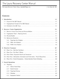
- The Laura Recovery Center Manual, by the Laura Recovery Center (LRC) Team, 2002, 84 pages.
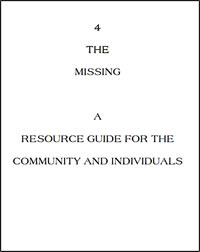
- A Resource Guide for the Community and Individuals, by 4 The Missing, undated, 19 pages
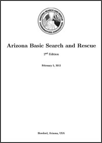
- Arizona Basic Search and Rescue, by Arizona Search and Rescue Coordinators Association, Ltd.. Hereford, Arizona, 2nd edition, 2013, 199 pages.
- Ground Search & Rescue (GSAR): SAR100 Participant Manual, by the Emergency Management Division, Justice Institute of British Columbia, 2nd edition, 1999, 302 pages.
- LandSAR Field Guide, by Steve Schreiber and Stu Allan, New Zealand Land Search and Rescue, 2010, 82 pages.
- Search Techniques Manual, by OSARVA Senior Search and Rescue Trainers, Ontario Search and Rescue Volunteer Association (OSARVA), 2016, 366 pages.
- Basic Land Navigation (PMS 475 NFES 2865) by the National Wildfire Coordinating Group (NWCG), US National Interagency Fire Center (NIFC), Boise, Idaho, US, 2007, 174 pages.
- Map Reading and Navigation (Part IV, Manual 7), Second Edition, by Emergency Management Australia, Attorney-General’s Department. Dickson, Australian Central Territory, Australia, 2001, 96 pages.
 |
|
| The Laura Recovery Center Manual, by the Laura Recovery Center (LRC) Team | |
The LRC Manual describes how to conduct a massive, citizen-directed effort to recover a missing child.
It is based on a triangle of trust among a missing child's family, law enforcement, and the community.
Contents:
- Introduction
- Purpose of the LRC Manual
- Organizational Concept of the LRC Manual
- Feedback to the LRC Team
- Recovery Center Organization
- Recovery Center Core Group and Responsibilities
Organization Chart / Nametag System - Physical Facility
- Information Sensitivity
- Targeting Area Displays
- Office Area Displays
- Public Area Displays
- Director's Summary
- Phase One - The First Six Hours
- Phase Two - The First 72 Hours
- Phase Three - Expanded Search and Assessment
- Phase Four - Information Assessment and Preservation / Search Rampdown
- Phase Five - Search Termination / Critical Incident Stress Debriefing
- Search Operations
- Targeting
- Master Search Map
- Search Journal
- Targeting Strategy
- Mapping
- Equipment Needed
- Shutdown Tasks
- Search Patterns
- Introduction
- Single Line Search
- Pivoting Line Search
- Multiple Pass Search
- Special Search Methods & Tasks
Briefing- Equipment Needed
- Briefing the Search Team
- Transportation
- Preservation of Evidence
- Search Team Status Board
- Search Team Communications
- Search Team Communications Desk
- Equipment Management
- Shutdown Tasks
- Debriefing
- Equipment Needed
- Equipment Needed
- Medical - First Aid
- Medic / First Aid Duties
- Searcher First Aid Kit
- First Aid Center Supplies
- Ambulance
- Administration
- Flyers
- TRAK Systems
- Flyer Creation
- Flyer Distribution
- Equipment Required
- Types of Flyers
- Flyer Content
- Flyers for Mass Distribution
- Specialty Flyers
- Shutdown Tasks
- FAX Operation
- FAX Distribution
- Stand Alone FAX
- Computer FAX
- Internet
- Web Site Maintenance
- Information for Web Pages
- Equipment Required
- Supplies Required
- Shutdown Tasks
- List Maintenance
- Volunteer List
- Recovery Center Directory
- Resource List
- Historian
- Records to be Archived
- Access to Historian Records
- Shutdown Tasks
- Phone Lines
- Required Phone Lines
- Core Group Cellular Phones
- Phone Bank Operations
- Equipment and Supplies
- Required by Phone Bank Personnel
- Information Required by Phone
- Bank Personnel
- Telephone Personnel Rules
- Telephone Personnel Rules
- Volunteer Registration
- Recovery Center Security
- Background Checks
- Security Camera
- Recovery Center Sign In - Name Tags
- Bouncer
- Search Party Photographs
- Counseling
- Resource Management
- Procuring Supplies
- Flyer Reproduction
- Flyer Distribution
- Food Management
- Start Up Tasks
- Recommended Food Management
- Food Management Suggestions
- Shut Down Tasks
- Public Affairs
- Media Strategist
- Media Spokesperson
- Family Liaison
- Legal & Financial
- Reward Fund Management
- Expense Fund
- Volunteer Agreements / Releases
- Recovery Center Shutdown
- Historian Records
- Feedback to the Laura Recovery Center Team
- Pre-Incident Preparation
- Being Prepared
- Field Training
- Prevention
- Web Page
- Missing Child Organizations
- Recommended Software
- Feedback to the LRC Team
- Appendix
- LRC Manual Copyright Notice
- Forms - Master Copies
 |
|
| A Resource Guide for the Community and Individuals, by 4 The Missing | |
The 4 The Missing Community Plan is designed to help bring together the missing person’s family, law enforcement and the community.
It is intended as a source of reference to help guide a community in coordinating a plan of action.
This reference guide describes how to help a family and law enforcement in the first 24 hours, how to notify and keep the community informed, and how to most effectively guide community volunteers in searching for a missing person.
Contents:
- Introduction
- Structure
- Coordinator
- Family Advocate
- Search Coordinator
- Community Awareness Liaison
- Media Liaison
- Donations Liaison
- Coordinator Responsibilities
- Physical Facility
- Setting Up Your Community Center
- Private Area Or Binder
- Public Area
- Family Liaison Responsibilities
- Community Awareness Liaison
- Flyer Distribution
- Media Liaison
- Community Search Coordinator
- Organized Community Searches
- Search Basics
- Evidence
- Donations Liaison
- Pre-Incident Preparations
 |
|
| Arizona Basic Search and Rescue, by Arizona Search and Rescue Coordinators Association, Ltd | |
This manual is an introduction to the basics of searching for missing persons in wilderness environments.
It is aimed at members of the public, primarily in Arizona, who are interested in becoming Search and Rescue (SAR) volunteers as well as at SAR personnel who are new or inexperienced in searches.
This should be considered an introduction only as there is much more to wilderness searching than is presented here.
Contents:
- Arizona Requirements, Policies, and Procedure
- How Search and Rescue is Organized in Arizona
- Arizona Requirements of Volunteers
- Arizona Policies and Procedures
- Continuing Education
- Introduction to Searches
- Who Do We Search For?
- What Types of Searches Are There?
- What Resources Do We Search With?
- How Do We Plan For a Search?
- When Do We Search?
- Behind the Scenes of a Route and Location Search
- Behind the Scenes of an Area Search
- Establishing the Search Area
- Segmentation
- Consensus
- Assign Resources to Search Segments
- Debrief Resources
- Update Segments
- Safety and Hazards
- Personal Hazards
- Local Hazards
- Environment Related Hazards
- Altitude Related Hazards
- Risk Management
- Risk Assessment
- Situational Awareness
- Communications
- Personal Preparedness
- Aviation Operations
- Vehicle Operations
- Incident Safety Analysis
- Wilderness Survival
- Personal Protective Equipment
- Map, Compass, and Land Navigation
- Maps
- Coordinate Systems
- Reading A 7.5’ Topographic Map
- Compass
- Conclusion
- Tracking
- Communications
- Incident Command System
- Appendices
- Lost Person Data
- Lost Person Behavior
- Lost Person Behavior Distance Traveled
- Survivability
- Search Urgency Rating Chart
- Probability
- SAR Glossary
- References and Index
 |
|
| Ground Search & Rescue (GSAR): SAR100 Participant Manual, by the Emergency Management Division, Justice Institute of British Columbia | |
This GSAR basic search and rescue manual is intended for ground SAR operators in the Province of British Columbia, Canada.
Contents:
- Introduction
- Search and Rescue in British Columbia (BC)
- Search Organization
- Initiating a Search
- Search Progression
- Search Termination
- Wilderness Navigation
- Maps
- Compass
- Map and Compass
- Searcher Skills
- Survival Skills
- Communications
- Orientation to Rope Management
- Orientation to Tracking
- Helicopter Safety
- Avalanche Orientation
- Evacuation
- Search Tactics
- Type I Methods – Initial Response Searches
- Type II Methods – Sweep Searches
- Type III Methods – Closed Grid Searches
- Shoreline Searches and Safety
- Chapter Review Answer Key
- Bibliography and Index
 |
|
| LandSAR Field Guide, by Steve Schreiber and Stu Allan | |
This LandSAR Field Guide is the foundation document for New Zealand Land Search and Rescue (LandSAR) members.
It serves as the ‘go to’ support document for those learning their trade with LandSAR.
Contents:
- Introduction
- Services
- Coordinating agencies
- Other key partners
- Who Does What
- Coordinated Incident Management System
- Organisation chart
- Field Personnel
- Team member
- Team Leader
- Sector Supervisor
- Talking to the media
- Food and Equipment
- Clothing and equipment
- Food
- Communications
- Very High Frequency
- High Frequency
- Cellphones
- Standard Operating Procedures
- Helicopters
- Roles and responsibilities
- Safety around a helicopter
- Working in and around a helicopter
- Winching (human sling load)
- Night operations
- Navigation
- Grid references
- Compass bearings
- GPS
- Searching
- Who are we looking for
- The bike wheel model
- How to search
- Track and Clue Awareness
- Types of sign
- Search methods
- Environmental techniques
- Rescue
- The six-step incident response process
- Rescue Action Plan
- When the missing party is found
- Death or dying
- Crashed aircraft
- Evacuation options
- Patient care
- Stretchers
- After the SAR operation
- Debrief
- Stress
- Fatigue
- Specialist Teams
- Alpine Cliff Rescue (ACR)
- Avalanche search
- Cave rescue
- Swiftwater rescue and rescue
- Dog teams
- Tracking
- Glossary
- Contacts
 |
|
| Search Techniques Manual, by OSARVA Senior Search and Rescue Trainers | |
This manual is intended to provide ongoing training and development for SAR operators across the Province of Ontario, Canada, with the goal of helping searchers become more effective team members and clue seekers.
Contents:
- Introduction
- SAR Structure in Canada
- A Shared Responsibility
- The National Search and Rescue Program (NSP)
- CAF Organization for Aeronautical and Maritime SAR
- Area of Responsibility (AOR)
- Ground Search and Rescue (GSAR)
- Incident Command System (ICS)
- What is ICS Canada
- History in Canada
- Principles of ICS
- Features
- Organizational Structure of the ICS
- GSAR Eligible and Ineligible Tasks
- Eligible Tasks
- Ineligible Tasks
- Team Protocols
- Team Roles and Responsibilities
- Team Leader
- Team Member
- Flagging Person
- Communications Person
- Navigator
- First Responder / First Aider
- Note Taker
- Searcher
- Legal Issues in Search and Rescue
- Civil Law
- Criminal Law
- Safety
- Individual Responsibility
- Team Responsibility
- Volunteers and the Labour Laws
- Injuries on Search
- WSIB Procedures
- Safety Program
- Forum for Discussion of Safety
- Finance and Administration
- Search
- Search is an Emergency
- How We Search
- Why do we Search
- Search Patterns
- Grid Search
- Hasty Search
- Track Crawl
- Binary Search
- Contour Search
- Perimeter Search
- Purposeful Wandering
- Attraction Methods
- Sound Attraction Methods
- Visual Attraction Methods
- Confinement Methods
- Road Block
- Trail Block
- Camp-Ins
- Lookout Post
- Listening Post
- Hip Chain
- Track Trap
- Staging Area
- Critical Distance / Separation
- Technique to Determine the Critical Distance
- Some Factors Affecting Critical Distance
- Night Search
- Urban Search
- The Urban Environment
- Potential Causes of Disappearances
- Missing Person in an Urban Setting
- Dementia
- Missing and Abducted Children
- Despondent
- Mentally Challenged
- Mental Illness
- Autism
- Substance Abuse
- Urban Search Tactics
- Door to Door Canvassing
- Urban Confinement
- Building Search
- Evidence Search
- Legal Challenges of an Urban Area
- Hazards of the Urban Area
- Clue Awareness
- Cognitive Vision
- Vision — The Eyes
- Analysis — The Brain
- Knowing What to Look For
- The Realization — We Can Always Improve Cognitive Vision
- Training Techniques
- Evidence / Clue Handling
- Tracking
- Basic Man-Tracking
- Track Identification
- Team Procedure for Identifying Clues
- Note Taking
- Missing or Lost Person(s) Found Procedure
- Dealing with Deceased Person(s)
- If Handling of Deceased Person(s) is Required
- Environmental Control Following Handling
- Why is a Coroner Called
- What is a Reportable Death?
- Inquest
- Equipment
- Individual Equipment
- Hour / Hour Packs
- Clothing
- Team Equipment
- Uniforms
- Personal Protective Equipment (PPE)
- Search Vehicles
- Mountain Bike
- All-Terrain Vehicle (ATV) and Snowmobile
- Personal Vehicles and SAR Response Vehicles
- Vehicle and Trailer Combination
- Helicopter
- Specialized Resources (Equipment)
- Specialized Equipment
- Specialized Vehicles
- Environment
- Weather
- Weather and its Effects on SAR
- Weather Information
- Weather Information Sources
- Storms
- Lightning
- Tornadoes
- Rain
- Winter – Cold Alerts
- Winter Warnings
- Snowfall
- Wind-Chill
- Prevention and Protection – Cold Shock
- Wind
- Summer – Heat Alert
- Humidex
- Ultraviolet Index
- Natural Hazards
- Natural Hazards and their Effects on SAR
- Flooding
- Landslide
- Fires
- Diseases
- Animals
- Animals and Their Effects on SAR
- Moose (alces alces)
- Black Bear (ursus americanus)
- Wolf (canis lupus), Coyote (canis latrans), Wild Dogs (canis familiaris)
- Massasauga Rattler (sistrurus catenatus)
- Striped Skunk (mephitis mephitis)
- Porcupine (erithizon dorsatum)
- Rabies
- Insects and arachnids
- Insects and their Effects on SAR
- Mosquitoes (West Nile Disease)
- Ticks (Lyme Disease)
- Bees (Anaphylaxis)
- Black Widow spider (Poisonous)
- Leeches
- Plants
- Plants and their Effects on SAR
- Canada Nettle (laportea canadensis)
- False Ragweed (iva xanthifolia)
- February Daphne (daphne mezereum)
- Giant Hogweed (heracleum mantegazzianum)
- Leatherwood (dirca palustris)
- Motherwort (leonurus cardiaca)
- Wild Parsnip (pastinaca sativa)
- Petty Spurge (euphorbia peplus)
- Pink Lady's-Slipper (cypripedium acaule)
- Poison ivy (rhus radicans)
- Poison Sumac (rhus vernix)
- Showy Lady's-Slipper (cypripedium reginae)
- Sneezeweed (helenium autumnale)
- Stinging Nettle (urtica dioica)
- Yellow Lady's-Slipper (cypripedium calceolus)
- Terrain
- Terrain and its Effects on SAR
- Ontario Terrain
- Forests
- Elevations, Hills, Cliffs
- Mine Shafts, Caves, Crevices, Wells
- Rivers, Creeks, Moving Water
- Ice
- Wetland (Pond, Marsh, Bog, Swamp)
- Rough Terrain, Ditches, Canals
- Garbage Dumps
- Construction, Industrial Sites
- Farmland, Pasture
- Gas Pipes Line, Power Lines
- Roads, Highways, Railroads
- Light
- Light and its Effects on SAR
- Light and the Eye
- Sunlight
- Night and the Eye
- Human Factors
- Individual
- Personal Qualities and/or Attributes
- Commitment
- Team Player
- Communication Skills
- Accountability
- Professionalism
- Responsibility
- Physical Demands
- Mental Fitness
- Physical Fitness
- Body Management
- Hydration and Nutrition
- Rest, Sleep and Fatigue
- Hygiene
- Foot Care
- Personal Waste Disposal
- Alcohol and Drugs
- Team
- Handling External Influences
- Critical Incident Stress
- Critical Incident
- Critical Incident Stress
- Signs and Symptoms
- Stress Management
- Critical Incident Stress Debriefing (CISD)
- Professionalism / Code of Ethics / Conduct
- Professionalism
- Codes of Ethics / Conduct
- Focus on Task at Hand
- Communication
- Radio
- Voice Procedures
- Pro-words
- Urgency Signals
- Radio Protocols
- Troubleshooting Loss of Signal
- Best Practices
- Team Communication
- Callout
- Sign-in / Sign-out
- Briefing
- Debriefing
- Initial Basic Infield Interviewing Techniques
- Media
- Social Media / Cell Phones / Cameras
- Social Media
- Cell Phones
- Cameras
- Training
- Probability of Detection (POD) – Probability of Area (POA)
- Point Last Seen (PLS) – Last Known Position (LKP)
- Initial Planning Point (IPP)
- First Aid
- Knots
- Wilderness Survival
- Group Survival
- Water
- Improvised Shelter
- Fire Starting
- Safety
- Signaling
- Psychology of Survival
- Navigation
- Map
- Compass
- Tally System
- Global Positioning System (GPS)
- Missing or Loss Person(s) Behaviors / Characteristics
- Behaviors and Characteristics
- Strategies Missing or Lost Person(s) Use to Reorient Themselves
- The Role of Emotion
- Specialized Resources (Human)
- Trackers
- K Teams
- Mounted or Equine Team
- Technical Rope Team
- Confined Space Rescue
- Water Rescue
- Light Urban Search and Rescue
- Logistical Support
- Communication Support
- Critical Stress Management Team
- Haz Mat Team
- Glossary
- References
- Acknowledgement
 |
|
| Basic Land Navigation (PMS 475 NFES 2865) by the National Wildfire Coordinating Group (NWCG), US National Interagency Fire Center (NIFC), Boise, Idaho, US, 2007, 174 pages. | |
This book is an excellent introductory manual for those wishing to learn about land navigation.
Contents:
- Preface
- Introduction
- Overview of Maps
- Key Points When Working with Maps
- General Types of Maps
- Incident Specific Maps
- Map Legend and Symbols
- Map Sources
- Checking Your Understanding
- Reading Topographic Maps and Making Calculations
- Reading the Margins
- Interpreting Contour Lines
- Estimating Slope
- EstimatingAspect
- Estimating Acreage
- Estimating Distances
- Estimating Percent Contained
- Checking Your Understanding
- Geographic Location Systems
- Latitude and Longitude
- Universal Transverse Mercator
- US Public Land Survey
- Other Geographic Location Systems
- Checking Your Understanding
- Using a Compass and Clinometer
- Parts of a Compass
- Tips on Getting Accurate Compass Readings
- Adjusting a Compass for Magnetic Declination
- Orienting a Compass
- Taking Bearings (Direct and Back)
- Following Bearings
- Estimating Slope with a Clinometer
- Checking Your Understanding
- Global Positioning System
- How the Global Positioning System Works
- Using a GPS Receiver
- Checking Your Understanding
- Navigation and Field Mapping
- Orienting Maps
- Measuring a Bearing on a Map
- Plotting Points on a Map using Latitude/Longitude
- Plotting Points on a Map using UTM
- Estimating Your Own Position Location
- Estimating Unknown Position Locations
- Estimating Distance on the Ground
- Field Mapping
- Taking Notes
- Checking Your Understanding
- Appendixes
- Appendix A – Glossary
- Appendix B – Answers to Exercises
- Appendix C – Tools and Resources
 |
|
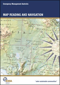
| Map Reading and Navigation (Part IV, Manual 7), Second Edition, by Emergency Management Australia, Attorney-General’s Department. Dickson, Australian Central Territory, Australia, 2001, 96 pages. | |
This is book is an excellent introduction to land navigation.
Contents:
- Reliability And Care Of Maps
- General
- Reliability Of Maps
- Care Of Maps
- Map Folding
- Map Border Information And Conventional Symbols
- Border/Marginal Information
- Title
- Type Of Map
- Edition And Sheet Number
- Magnetic Variation Diagram
- Grid Reference Block
- Symbols Legend
- Control And Production Data
- Index To Adjoining Sheets
- Reliability Diagram
- Linear Scale
- Representative Fraction
- Contour Interval
- Conventional Map Symbols
- Symbols Explanations
- Scale, Measuring Distance And Judging Distance
- Map Scale
- Expressing Map Scale
- Measuring Distance On A Map
- Methods
- Judging Distance
- Methods
- Conditions Affecting Apparent Distance
- Grid References
- The Grid System
- Grid Lines
- Orientation
- Grid References
- Grid Squares
- Position Identification
- The Universal Grid Reference System
- Universal Grid References
- Reference Example
- Grid Zone Junctions
- Romer Scales
- Using The Scale
- Ground Shape, Gradients And Intervisibility
- Introduction
- Relief
- Elements Of Representation
- Methods Of Showing Relief
- Contour Patterns
- Representation Of Height
- Common Methods
- Map Reading Terminology
- Physical Features
- Gradients
- Measuring Gradients
- Calculating Distance By Pacing
- Maximum Gradient For Vehicular Use
- Intervisibility (Line Of Sight)
- Obstructions
- Making A Section
- Direction
- The Compass
- Cardinal Points
- The Degree System
- Bearings
- North Points
- True North
- Magnetic North
- Grid North
- Grid And True Bearings
- Protractors
- Using A Protractor
- Plotting A Bearing
- The Douglas Protractor
- Magnetic Variation/Declination
- Pole Movement
- Isogonals
- Conversion Of Bearings
- Conversion Problems
- Easterly Variation
- Westerly Variation
- Conversion Diagram
- Back Bearings
- Compasses
- General
- The Prismatic Compass
- Field Use In Daylight
- Setting A Prismatic Compass For Night Movement
- The Orienteering Compass
- Using An Orienteering Compass
- Back Bearings
- The Electronic Compass
- Altering Direction To Avoid An Obstacle
- Compass Errors
- Individual Compass Error
- Local Magnetic Attraction
- Map Orientation, Position Fixing And Map Enlargement
- Map Setting
- Setting By Inspection
- Setting By Compass
- Position Fixing By Compass Resection
- Procedure
- Resection By Overlay
- Map Enlargement
- Method Of Enlargement
- Adding Information
- Cross-Country Navigation
- Introduction
- General
- Navigation Aids
- Maps
- Aerial Photography
- Compass
- Improvised Navigation By The Sun
- Direction From The Stars
- Planning
- Map Study
- Navigation Data Sheet
- Maintaining Direction Using A Compass
- Preferred Method
- Checking
- Summary
- Navigation Under Special Conditions
- Action If Lost
- Considerations
- Position Fixing
- Briefing Details
- Aerial Photography
- Introduction
- Photo Reading And Photo Interpretation
- Photo Reading
- Photo Interpretation
- Photo-Map Comparison
- Maps
- Air Photos
- Summary
- Types Of Aerial Photography
- Vertical Photographs
- Oblique Photographs
- Stereoscopy
- Stereovision
- The Stereoscope
- Using The Stereoscope
- Mosaics
- Types Of Mosaics
- Latitude, Longitude System And Marine Charts
- Introduction
- Map Variations
- Marine Navigation
- Units Of Measure
- Main Systems
- Knots Vs Kilometres Per Hour
- Other Terms Of Nautical Measurement
- Conversion Factors
- Identification Of Locations On Charts
- Meridians Of Longitude
- Parallels Of Latitude
- Degrees, Minutes And Seconds
- Conventions For Stating Positions
- Use Of Seconds
- Measuring Distances On Charts
- Mercator Projection
- Measuring Process
- Gnomonic Projection
- Summary
- Global Positioning System
- The Global Positioning System
- How GPS Works
- What A GPS Can Do
- GPS Navigation
- GPS Performance And Limitations
- Grid Coordinates
- Manufacturers Instructions
- Geocentric Datum Of Australia
- Geocentric Datum Of Australia
- Benefits
- Differences
- Implications
- Geographic Information Systems
- The Geographic Information System
- Glossary
| << Prior Chapter | Next Chapter >> |
People who say it cannot be done,
should not interrupt those who are doing it.
— Author unknown
If you've been able to read this
Web page...
thank a Teacher;
If you've been able to read this
Web page in English...
thank a Veteran.
— Author unknown
Copyright © 1984-
March 23, 2021
by Michael A. Neiger
Contact Michael Neiger via e-mail at mneiger@hotmail.com
Top
You're here: MibSAR :: M-P Sourcebook Table of Contents :: Search