
You're here: MiBSAR's home page :: SAR operations log page :: SAR op photo-journal page
Michigan Backcountry Search
and Rescue (MiBSAR)
SAR Op No. 1 photo-journal:
Joe Clewley missing-person investigation
By
Michael Neiger
Marquette, Michigan
© Copyright 2008
Duration & date: Agency assisted:
_____________________
Sault Ste. Marie, MichiganTownship & County: Nearest place-name: General location: Tahquamenon Falls State Park in the eastern Upper Peninsula Trail: Victim: Joseph Robert Clewley
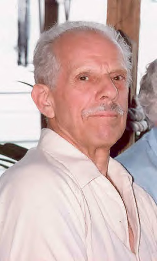
White male; age 73; 5'-10"; 150 lbsCase summary: Joe Clewley and his dog Chip went missing on July 13, 2008. His van was found parked at the North Country Trail (NCT) trailhead along the Tahqua Trail in the eastern reaches of Tahquamenon Falls State Park. Joe owned a log cabin in the area and enjoyed hiking off-trail in the park. SAR op mission: MiBSAR team members: Partner SAR teams & assets: SAR op results: Joe Clewley was not located Additional resources: • Learn more about this investigation
• View official, Sheriff's Office-provided Web site for victim
• View MiBSAR-provided Web site and Internet blog for victim
Friday, July 25
The debriefing
Shortly after I left Marquette for the search area near Paradise, Michigan, I was overtaken by a violent storm so massive it covered much of the Upper Peninsula. I knew in advance to expect 50 mile-per-hour winds, with gusts of 70 possible, particularly to the south. I learned later this same storm spawned a tornado further south on the Peninsula.
After an uneventful drive of 146 miles, I arrived in Paradise and made contact with Joe Clewley, Jr., whose father, Joe Clewley, Sr., was missing; Scott, a close family friend; and Det./Sgt. Mike Bitnar, the lead detective on the case from the Chippewa County Sheriff's Office.
The Joseph Clewley search area in Tahquamenon Falls State Park, near Paradise, Michigan. (Graphic courtesy of Michael Neiger)
We all met at the Clewley camp--historically known as the Chippewa Hunting Post--a quaint, circa-1920s, two-room log cabin perched atop the north bank of the Tahquamenon River. As I pulled up, Joe Jr. walked across the yard to greet me. Once out of the rain, I spent four hours debriefing Joe, his friend Scott, and Det. Bitnar, trying to learn as much as I could about the investigation to date. They were all extremely helpful.
Joe Clewley's circa-1920, two-room, log cabin—The Chippewa Hunting Post—along the north bank of the Tahquamenon River. (Photo by Michael Neiger)
Joe Clewley's circa-1920, two-room, log cabin—The Chippewa Hunting Post—along the north bank of the Tahquamenon River. (Photo by Michael Neiger)
With my preliminary questions answered, and an armload of aerial photographs, posters, quads, maps with bread-crumb plots of prior search-and-rescue crews, and several pages of notes, I departed the Clewley cabin just after midnight. Due to the late hour, I bivouacked near the trailhead for the North Country Trail (NCT), which was located just down the Tahqua Trail a bit.


Saturday, July 26
Sweeping the NCT
With the case at hand on my mind all night, I did not sleep very well. Unable to sleep, I got up as the sun rose and pulled on my boots, leaned my ruck against a jack pine, and boiled up some water in my billy on a solid-fuel (Esbit) wing stove. After enjoying a cup of hot chocolate and wolfing down my breakfast--a 1,350-calorie mixture of six packets of Quaker oatmeal, a half cup of cashews, and a half cup of dried rasberries--I threw my ruck in the back of the van and headed south on the Tahqua Trail to do a quick recon of the area for future search ops.
Well into a large section of private property, the road narrowed and became a series of mud holes filled with greasy, wet clay. Unable to drive any further without risking getting stuck, I parked the van and walked down to the point where the private land abutted state land. This was reportedly the southernmost point where earlier search-and-rescue crews had searched. I made a mental note to return and check this area with a MiBSAR crew.
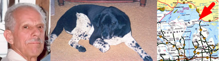
Joseph Clewley and his dog Chip have been missing near the North Country Trail, south of Paradise, Michigan, since July 12, 2008. (Photo courtesy of the Chippewa County Sheriff's Office.)
Wanting to grab a photograph of the vehicle Joe Sr. had left parked at the trailhead before he went missing, I returned to his log cabin on the Tahquamenon River and snapped a couple shots of it. Looking the secluded cabin over, it was easy to understand why Joe would choose to spend six to eight months of the year here. The view of the Tahquamenon River from his screened-in porch was beautiful, especially with the rising sun.
Joe Clewley's 1992, Oldsmobile, Silhouette van, after having been removed from the North Country Trail trailhead along the Tahqua Trail. (Photo by Michael Neiger)
Photos in hand, I returned to the NCT trailhead, parked my van, and shouldered my ruck. Since the NCT cut through the heart of the search area, I decided to hike it--and scent-check it for abnormal odors--from the trailhead on Tahqua Road to where it cut the Timberlost Road, a narrow, sandy, north-south-running two-track.
The North Country Trail Trailhead along the Tahqua Trail where Joe Clewley's 1992 Oldsmobile was found. (Photo by Michael Neiger)
Along the way, I crossed the main and upper west branches of Lynch Creek, both of which were bridged by wooden walkways on the downstream side of beaver-created floodings. Bordered by expansive stretches of rich marshland, these two areas are favorite wildlife-watching areas of Joe Sr.
The beaver pond located along the North Country Trail on the upper west branch of Lynch Creek. (Photo by Michael Neiger)
The beaver pond located along the North Country Trail on the main branch of Lynch Creek. (Photo by Michael Neiger)
After cutting through a stretch of dark, foreboding lowlands, I climbed several contours to hike along a very nice south-facing ridge. Looking over my shoulder about noontime, I glimpsed a distant view of Lake Superior's Whitefish Bay.
Before long, I had passed abreast of a chain of lakes known as the Camp 10 Lakes and arrived at the point where the east-west-running North Country Trail is cut by the north-south-running Timberlost Trail. Signage indicated this was also the junction with the Old Stove Road. Nearby artifacts--rusted pieces of an old woodstove--confirmed this as did the rotting outline of a 11- by 14-foot log cabin.
Unfortunately, the hike along this stretch of the NCT did not reveal any spoor--dog tracks or scat--that would have helped locate Joe's dog Chip, which in turn might have led us to Joe's location. Likewise, I did not scent any unusual odors being carried along by a strong, north-northwesterly breeze.
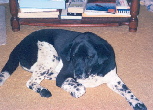
Chip, Joe Clewley's dog, is a black-and-white chow-springer mix. (Photo courtesy of the Chippewa County Sheriff's Office.)
Seeing it was 1:30, I paused for lunch--a bagel, two pieces of cheese, a bag of jerky, and two cookies. Still hungry, I grabbed a few handfuls of blueberries, which seemed to be everywhere. Just as Det./Sgt. Bitnar had said, the bears would not be a problem as they'd likely gorged themselves on berries before I arrived.
Lunch finished, I set about searching an area that Joe Jr. and Det. Bitnar said earlier search crews had heard a distant barking dog, south of the NCT. They also mentioned that fresh dog tracks on the trail had led them to set out motion-activated cameras in hopes of identifying whether the dog was in fact Chip. Unfortunately, the cameras did not capture any photos of the dog responsible for the tracks.
1:24,000 USGS quad showing areas searched (in red) by the Michigan Backcountry Search and Rescue Team during Clewley Search Op No. 1, July 25-28, 2008. Click on image to view high-resolution imagery. (Graphic by Michael Neiger)
My job for the remainder of the day and Sunday was to work this area--which I named Coyote Den Swamp--in earnest in hopes of shedding some light on this issue. There was some hope this area might be productive based on information I had received, especially considering it was out of range for prior search-and-rescue teams.
I crisscrossed much of the high ground--ridge tops as well as side slopes--with negative results. Several expansive sandy areas on a ridge south of the NCT, which had been washed clean of old sign by the previous storm, lacked any fresh dog-type tracks or scat.
Along a sandy slope near the western limit of a razorback ridge, I found seven, weathered, 13-inch-long man tracks in the sand. Aligned along an axis of 141 magnetic degrees, the tracks--heel, arch, and foresole apparent--were headed southeasterly.
Their location atop the razorback ridge was as follows: UTM 0641598mE 5158486mN (zone 16, NAD 1927 CONUS); Latitude N46°34.019" W85°09.145". From this location, Timberlost Road is situated 580 meters distant along a 276 magnetic degree (west) azimuth; the North Country Trail, at its closest, is situated 150 meters distant along a 049 magnetic degree (northeast) azimuth. It should be noted that a very deep ravine separated this location from the NCT.
I also ventured further south, into Coyote Den Swamp, and checked a couple of island-like ridges within it, but found nothing.
It was a very hot day, and despite starting out fully rehydrated at 2:00 p.m., and with two quarts of water in my ruck, I ran out of water in the middle of the swamp while looking for Chip. With more searching left to do, and far from a good water source, I was forced to use the cap from my water bottle to dip red-wine-colored swamp water from a slight depression among patches of sphagnum moss. I treated it with iodine tablets as usual, but doubled the contact time. It looked bad, tasted like it looked, but it quenched my thrist just fine, allowing me to spend several more hours in the area.
A bit of rain fell about 2:30 p.m.
Throughout the afternoon, I repeatedly came across remnants of an old logging-era railroad grade--a slightly raised grade with numerous, small burrow pits along both sides--down in the swamp. I was able to plot more of its location the following day. Just east of the swamp, I came across an old, green deer blind with wide skis attached to one side.
At seven o'clock, tired and hungry from a long day of searching with a full rucksack, I headed back north, out of the swamp and across the NCT, where I ended up bivouacking just back from the south shore of Lake 708 in the chain of lakes known as the Camp 10 Lakes. Hot and sweaty, I went for a long swim in the company of sandhill cranes, common loons, and a bald eagle.
I watched the sun set over Lake 708 as I sipped chai tea and ate my 2,000-calorie dinner of freeze-dried beef stroganoff with noodles, a half cup of dried peas, and a half cup of sliced almonds; salty Pringles potato chips; and four pilot biscuits (hardtack) smeared with peanut butter, grape jam, and strawberry jam. For dessert, I had a cup of hot chocolate, a package of sport beans, and two oatmeal cookies.

Sunset over Lake 708 in the chain of Camp 10 Lakes. (Photo by Michael Neiger)
As night set in, so did the mosquitoes. And dozens of slimly slugs crawled on my equipment and clothing. Very tired, I climbed in my bivouac sack about 9:30 p.m., after removing all of the slugs. High winds with a bit of rain woke me at 11:30 p.m.


Sunday, July 27
Coyote Den Swamp
Awoke refreshed at 6:30 a.m. Slathered on some DEET and lit up an anti-bug smudge coil to keep the hungry mosquitoes at bay.
After running out of water in the swamp yesterday, I filled my ruck with 5 quarts of water from Lake 708 before heading out to look for any sign of Joe and Chip at 8:00 a.m. By 9:00 a.m., I had reached the northern edge of Coyote Den Swamp. I spent the morning cutting several long azimuths through this swamp, which was a mess. Thick, wet, and tangled with tag alders, it was interlaced with fallen spruce and cedar trees. I also passed through pockets of chest-high ferns and areas with standing water.
The only canine-family scat I came upon was on a game trail situated on a ridge at the swamp's western limit. I also saw small bear tracks and a spot where a ruffed grouse had been drumming, concealed beneath an evergreen bough.
By early afternoon, I had finished my recon of Coyote Den Swamp and the adjoining ridges. I then headed easterly, along a very long ridge that would end at one of Joe's favorite haunts: an isolated beaver flooding in section 13. About 3:30 p.m., I came across some interesting aerial spoor along the ridge: a clump of gray, curly, underbelly hair--possibly from a passing timber wolf--snagged on a deadfall.
I arrived at the beaver flooding at 4:30 p.m. It was a beautiful sight, impounded as it was by an 8-foot-high dam. I took several photographs of it as well as another similar flooding situated just to the north.
One of Joe's favorite, but more remote, beaver ponds--impounded by a monstrous, 8-foot-high dam--secreted away in northwest quarter of section 13. (Photos by Michael Neiger)
Another beaver pond is located just to the north of the one impounded by the 8-foot dam. (Photos by Michael Neiger)
Having reached the ponds, I reversed course and headed back west to my bivouac location on Lake 708. Along the way, I reconned another isolated ridge, but found nothing.
Back at Lake 708 by 6:00 p.m., I enjoyed a long, relaxing swim, ate dinner, and went to bed before the sun set.
Lake 708 in the chain of Camp 10 Lakes. (Photo by Michael Neiger)
At 10:30 p.m., I was awakened by the sound of barking in the distance. I quickly grabbed by compass and shot, and re-shot, an azimuth in the direction it was coming from. With a magnetic azimuth of 033 degrees, I was able to figure the probable location of the barking, which seemed to be from two different dogs, one howling and one barking. Once I converted the field azimuth to a map azimuth, and plotted it on my quad, I could see the barking was likely coming from somewhere near the old Soo Hunting Club, which was situated in the southwestern quarter of section 1, along the east shore of Lake 721 in the Camp 10 chain of lakes. A short time later, I heard some coyote chatter just to the east of the barking.


Monday, July 28
Lynch Creek Marsh
After breakfast and a cup of hot chocolate, I shouldered my ruck and headed for the North Country Trail. Once on the NCT, I followed it until I came to the point where it was cut by the main branch of Lynch Creek. At the bridge over the creek, I dropped my ruck and probed beneath it with my hands as well as a long stick, just in case any evidence was trapped beneath it.
Finding none, I climbed down into the river proper, wading downstream in the waist-deep swamp water, muck, and marsh grass along the creek's northern edge. Eventually, I came to the creek's confluence with the upper west branch of Lynch Creek. After fording the west branch, I worked my way across a beaver dam impounding the main branch and proceeded to wade upstream through the muck and waist-deep swamp water located along the south side of the main branch. Once back at the NCT, I climbed atop the bridge, shouldered my ruck, and headed for my van, which was parked at the NCT trailhead on Tahqua Trail.
Before I headed home, I went for a swim in the Tahquamenon River to wash off four days of grime.
While I left a bit dejected at not having found any sign of Joe or his dog Chip, I vowed to continue the search the following weekend.
Return to top of page :: Return to home page
In God's wilderness
lies the hope of the world,
the great, fresh, unblighted,
unredeemed wilderness.
—
John Muir, 1838-1914
Alaska Wilderness, 1890
If
you've been able to read this Web page...
thank a Teacher;
If you've been able to read this Web page in English...
thank a Veteran.
—Author
unknown
•
Copyright notice •
Content Copyright © 1984 --
2009-09-16
by Michael A. Neiger
• All rights reserved •
No part of this Web page or this Web site protected by copyright law may be reproduced, transmitted, or used in any form--including graphic, electronic, Web, mechanical or other form--or by any means--including photocopying, recording, taping, Internet distribution, information storage retrieval system, or by other means--for any purpose, except by a reviewer, who may quote brief passages, without the prior, express, written permission of the author.
Comments?
Suggestions?
Dead links? Inaccurate info?
Contact the WebMaster, Michael A. Neiger, at mneiger@hotmail.com
Web site URL: www.MibSAR.com
Return to top of page :: Return to home page
You're here: MiBSAR's home page :: SAR operations log page :: SAR op photo-journal page