
You're here:
MiBSAR's home page :: SAR
operations land navigation resource index page :: Latitude/Longitude
page
Michigan Backcountry Search and
Rescue (MiBSAR)
The latitude/longitude (LAT/LON)
geographic coordinate system
By
Michael Neiger
Marquette, Michigan
© Copyright 2005, 2010
Thanks in advance for reporting any errors, inaccuracies, or missing information in this primer to the author.
Page index
- Introduction
- History of lat/lon system
- Parallels of latitude
- Meridians of longitude
- Introduction
- Notable meridians
- Longitudinal coordinates
- Calculating & plotting lat/lon coordinates on topo maps
- Lat/lon & UTM format conversion utilities:
- Introduction
- Lat/lon & UTM format conversion Web sites
- Lat/lon & UTM format conversion via GPS units
- Lat/lon format manual conversion formulas
- Lat/lon coordinate lookup Web sites
- References
Top
Introduction to the
latitude/longitude coordinate system
Today's latitude/longitude
coordinate system is an extremely accurate and unambiguous way to describe
any location on the earths surface. Of all the geographic coordinate
systems, it is the one most often found on maps, charts, and globes. It
is also the most commonly understood and often used coordinate system
in existence.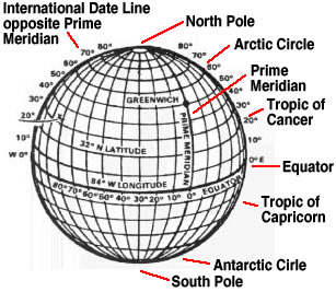
The system consists of an imaginary, two-coordinate grid overlaid on the earths spherical surface. The grid framework consists of an unlimited number of parallels of latitude, which are represented by the horizontal lines on a map or globe, and meridians of longitude, which are represented by the vertical lines on a map or globe.
The grid systems zero point--0° latitude and 0° longitude--is defined as the place where the north-south running system base line, known as the prime meridian, crosses the east-west system base line, known as the equator. It is situated in the Gulf of Guinea in the Atlantic Ocean, about 375 miles south of the coast of Accra, Ghana, in western Africa.
A specific location
within the latitude/longitude grid system is described by two angular
descriptors, both of which are measured with respect to the center, or
core, of the earth. A locations latitudinal descriptor is represented
by the angular deviation of its local parallel from the equator, or zero-degree
line of latitude. A locations longitudinal descriptor is represented
by the angular deviation of its local meridian from the prime meridian,
or zero-degree line of longitude.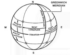
By design, no two locations on the earths surface can have the exact same parallel and meridian combination. In other words, every latitude/longitude coordinate combination identifies a unique and individual geographical location on the earths surface.
***Lat/lon diagrams adapted from the U.S. Army's Map Reading and Land Navigation Field Manual (FM 3-25.26, rev. 20 July 2001, formerly FM 21-26)
Top
An
historical overview of the
latitude/longitude coordinate system
The latitude/longitude geographical coordinate system is the oldest known map-coordinate system in the world. As far back as 500 BC--some 2,500 years ago--the Greeks were using a rudimentary version to make celestial and terrestrial measurements and observations. By observing the sun, moon, planets, and stars with angle- or altitude-measuring devices, they were able approximate their terrestrial position. For seafarers of the time, accurately fixing their location while underway could mean the difference between life and death.
Through the centuries, the latitude/longitude coordinate system has evolved into an increasingly accurate means of locating ones position on the earths surface and making measurements between different terrestrial locations. Along with improvements in the coordinate system, the last 2,500 years have witnessed the invention and development of various aids to navigation such as angle-measuring devices and the timekeeping instruments.
Quadrant. The medieval quadrant was probably the first angle-measuring instrument utilized for measuring latitude. As its name implies, the quadrant was configured as a quarter-of-a-circle (90 degree) arc instrument. Made of wood or brass, this portable, planispheric (flat), wedge-shaped instrument included two sights situated along one of its straight edges and a degree scale along its radius. The graduated degree scale combined with a weighted line, or plumb bob, hung from the apex, served to indicate a celestial bodys angle, or altitude, from the horizon.
In the northern hemisphere, latitude was calculated by measuring the angle between the horizon and the polar star, and then correcting this figure for the minor deviation between the polar star and the celestial north pole. In the southern hemisphere, latitude was calculated by measuring the angle between the horizon and the sun, and then correcting for the suns declination.
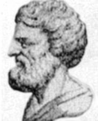 |
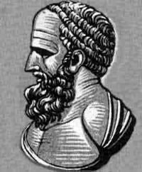
| Apollonius of Perga, circa 262 BC-circa 190 BC. (Photo courtesy of University of St. Andrews, St. Andrews, Scotland) |
Astrolabe. The astrolabe was a medieval instrument used to measure latitude. Its name was derived from the Latin words astro, meaning star, and labio, meaning finder.This portable, angle-measuring instrument may have been invented in the 3rd century BC by Apollonius of Perga. It was a whole-circle (360 degree) planispheric, angle-measuring device constructed of brass or iron. Over the ages, it took on many forms.
In its simplest form, it consisted of two principal parts: the "mater," which was a large, circular base plate or frame graduated in degrees along its edge; and an "alidade," which was a rotating straight rule with a dual-sighting mechanism. Later models added rotating disks--such as the "rete" and the "tympan," for example--that bore celestial diagrams and charts, essentially creating a two-dimensional celestial model.
Apollonius of Perga (circa 262 BC-circa 190 BC) was a Greek mathematician, geometrician, and astronomer. Known as "The Great Geometer," his works included the Conics (a series of 8 books on the field of conic sections)¸ Cutting-off of a Ratio, Cutting off of an Area, On Determinate Section, Tangencies, Vergings, On Contacts, On Plane Loci, On the Cylindrical Helix, Comparison of the Dodecahedron and the Icosahedron, Quick Delivery, On Unordered Irrationals, and On the Burning Mirror.
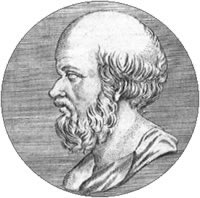 |
| Eratosthenes of Cyrene, circa 284 BC-circa 194 BC. (Photo courtesy of Enciclopedia Libre Universal en Español) |
Eratosthenes and the lat/lon system. Some of the initial work on the latitude/longitude coordinate system was done during the 3rd century BC by Eratosthenes of Cyrene. While he is credited with charting lines of latitude and longitude on the earths surface, his charting was rudimentary and irregular at best. His system also relied on inaccurate, terrestrial-based measurements.
Eratosthenes of Cyrene (circa 284 BC-circa 194 BC) was a Greek astronomer, geographer, grammarian, philosopher, mathematician, scholar of natural history, writer, and poet. He was the chief librarian at the Alexandrian Museum in Alexandria, Egypt and is most famous for making the first accurate, scientific measurement of the earths circumference using the suns rays--his estimate was accurate to within 50 miles of today's accepted standard. Hailed as the father of geodesy--the study of the earths size, shape, gravity, and surface locations--Eratosthenes is also credited with founding scientific chronology and astronomical geography. He cataloged 675 stars. His works included Geographica, On Ancient Comedy, Erigone, Hermes, Hesiod, Duplication of the Cube, On Means, Platonicus, On the Measurement of the Earth, Chronographiai, and Catasterisms.
 |
| Hipparchus of Nicaea, circa 194 BC-circa 120 BC. (Photo courtesy of University of St. Andrews, St. Andrews, Scotland) |
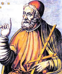 |
| Ptolemy of Alexandria, circa AD 100-circa AD 180. (Photo courtesy of Wiki's TuckerResearch) |
Hipparchus and the lat/lon system. By the 2nd century BC, Hipparchus of Nicaea had improved upon Eratosthenes latitude/longitude coordinate system. He is credited with plotting the lines of latitude and longitude at regular, fixed intervals. He also increased the coordinate systems accuracy by applying trigonometry and spherical geometry, and relying upon astronomy-based measurements.
Hipparchus of Nicaea, or Hipparchos, (circa 194 BC-circa 120 BC) was a great Greek astronomer, and mathematician. Considered the father of the science of astronomy, Hipparchus is credited with cataloging some 850, or possibly even 1080, stars; determining the length of the solar year; discovering the eccentricities of solar orbit and the procession of the equinoxes (his greatest discovery); determining the relative size of the sun and the moon as well as their distances from the earth; inventing the planisphere and possibly the astrolabe; and inventing stereographic projection and chordal trigonometry. Some of Hipparchus 14 works included Commentary on the "Phenomena" of Aratus and Eudoxus, On the Magnitudes and Distances of the Sun and Moon, The Movement of the Moon in Latitude, On Bodies Carried Down by Weight, and On the Displacement of the Tropical and Equinoctial Points (circa 128 BC)
Ptolemy and the lat/lon system. In the 2nd century AD, Ptolemy of Alexandria made further improvements upon Hipparchus conception of the latitude/longitude system. In Geographia, a monumental, eight-volume treatise on general geography, which remained authoritative until the 15th century, Ptolemy wrote about mathematical cartography, coined the terms meridian and parallel, and cataloged a number of place names along with their corresponding latitudes and longitudes. However, inaccuracies abounded, including his estimate of Eurasias longitude, an error that was said to have encouraged Christopher Columbus to make his famous 1492 westward sailing voyage, which ultimately resulted in the discovery of the New World.
Ptolemy of Alexandria (circa AD 100-circa AD 180), whose full Latin name was Claudius Ptolemaeus, was a brilliant Greek-Egyptian astronomer, astrologer, mathematician, geographer, and scientist. A librarian in Alexandria, Egypt, and second only to Aristotle in influence, Ptolemys theories remained immensely popular for some 1,400 years. His works included Almagest (his most famous work), Analemma, Planisphaerium, Optica, Tetrabiblos, and Harmonica.
The magnetic compass. By the 11th century AD--if not earlier--the magnetic compass had been discovered and was in use. The first compasses were fashioned of lodestone--a naturally-occurring iron-bearing ore with magnetic properties. The lodestone was attached to the top of a splinter of wood or a piece of straw, reed, or cork, which was then floated in a container of water so it could rotate freely and orient itself in a north-south direction.
Eventually lodestone was used to magnetize a needle-shaped piece of iron or steel. By the 13th century, rotating compass needles and compass cards, balanced atop pin-like posts in bowl-shaped containers, were in use. It was not until the 15th century that compass users began to realize that their compasses did not point directly to the terrestrial north pole but to some other nearby location, which came to be known as the magnetic north pole. By the 19th century, liquid-filled compasses had replaced dry compasses.
Navigational maps and charts. While crude maps were drawn on clay tablets and animal skins as far back as 2500 BC by the ancient Babylonians, the Chinese are credited with printing the first maps during the 12th century AD.
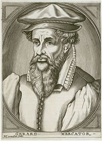 |
| Gerhardus Mercator 1512-1594. (Photo courtesy of the National Maritime Museum in London, United Kingdom) |
Mercator maps. In 1569, the Mercator map was developed by Gerardus Mercator. His revolutionary maps used the Mercator projection--a technique which was named after him--to represent the earths three-dimensional, sphere-shaped surface on two-dimensional paper. The Mercator projection used the cylindrical projection method in which both parallels and meridians were represented as straight lines. This groundbreaking discovery allowed navigators to calculate both distance and direction from their maps.
Gerhardus Mercator (1512-1594), or Gerardus or Gerard (his given name was Gerhard or Gerard De Cremer [or Kremer], but he chose to use his Latin name), was a Flemish cartographer, court cosmographer (geographer), calligrapher, mathematician, talented scientific-instrument maker, professor, engraver, and surveyor who is credited with creating the first modern, 18-sheet world map using his Mercator projection technique. He created the Atlas, or Cosmographical Meditations on the Structure of the World, the first modern atlas (a term he invented for a work envisioned to explain the creation of the world as well as lay out its complete history). In addition to publishing numerous notable maps and charts, and constructing celestial and terrestrial globes, his other works included a thorough guide to italic lettering as well as On the Use of the Astronomical Ring, Chronologia, and Tabulae Geographica.
Cross-staff. During the 16th century AD, the portable cross-staff widely replaced the astrolabe for calculating latitude. Also known as the Jacobs staff, the cross-staff was nothing more than a graduated vertical staff with an adjustable crosspiece that allowed the user to measure the angle between the horizon and a celestial body, usually the north star or the sun.
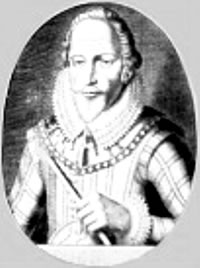 |
| John Davis circa 1550-1605. (Photo courtesy of 17th century painting via Wiki) |
Backstaff. By 1594, John Davis had improved upon the cross-staff with the development of the portable backstaff, or shadow-staff, which did not require the user to look directly into the sun. It was popular for nearly 150 years.
John Davis (circa 1550-1605), or Davys, was a proficient English seaman, explorer, first-rate navigator, naval combatant, writer, and inventor. He commanded the Black Dog against the Spanish Armada in 1588, invented the double quadrant, and devised the ships log, which became a standard tool for future navigators. Before his death at the hands of Japanese pirates near Singapore, his discoveries included the Davis Strait, which is located between Greenland and Canadas Baffin Island and bears his name, and the Falkland Islands. Known as the father of arctic discovery for his efforts to find a northwest passage to India, his nautical works included The Seamans Secrets (1594) and The Worlds Hydrographical Description (1595).
Vernier scale. In 1631, Pierre Vernier invented the graduated scale--or vernier scale--which represented a tremendous improvement over the transversals method (a geometric technique where a straight line cuts a system of other lines) of reading angular scales and linear rules. This mechanical device consisted of two parallel, sliding scales--a large main scale and a smaller auxiliary, or vernier, scale--that greatly increased the accuracy with which fractional parts or subdivisions of a single division on a fixed scale could be read.
Pierre Vernier (circa 1580-1637) was a French mathematician, government official, and inventor who published a number of works including The Construction, Uses, and Properties of a New Mathematical Quadrant (1631).
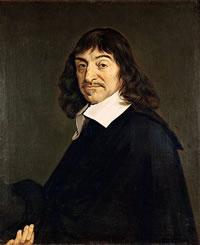 |
| Rene Descartes 1596-1650. (Photo courtesy of Louvre Museum, Paris, France) |
Descartes and the lat/lon system. By the 17th century AD, Rene Descartes had further refined and systemized the latitude/longitude coordinate system. In Geometry, his famous 1637 work, Descartes laid out the principles of co-ordinate or analytical geometry and applied them to the latitude/longitude coordinate system.
Rene Descartes (1596-1650) was a celebrated French philosopher, mathematician, scientist, and writer. His Latin name was Renatus Cartesius. Known as the father of modern, rationalistic philosophy, Descartes philosophy came to be called Cartesianism. His accomplishments included inventing co-ordinate or analytic geometry through the merging of algebra and geometry. An opponent of Scholastic Aristotelianism, Descartes devoted himself to explaining man and the universe through the application of mathematics, logical reasoning, and experimentation. He became famous for the Latin axiom, cogito, ergo sum, which translated to "I think, therefore I am." Descartes works included Discourse on the Method for Rightly Conducting Ones Reason, and Searching for Truth in the Sciences (1637; his most famous work), which became known as the Discourse on Method; Meditations on First Philosophy (1641; his principal philosophical work); and Principles of Philosophy (1644).
Telescopic sighting mechanism. In 1640, William Gascoigne invented the telescopic sight, which greatly improved the accuracy with which a telescope could be aimed. His design combined crosshairs fashioned from spider web material with a refractor.
William Gascoigne (circa 1612-1644), or Gascoygne, was an English amateur astronomer, inventor, and soldier who invented the micrometer in 1641 and developed glass-grinding methods.
 |
| Olaus Roemer 1644-1710.. (Photo courtesy of J P Trap via Wiki) |
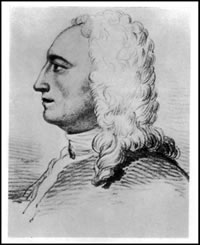
Meridian transit. Also known as a meridian circle, transit circle, transit instrument, transit telescope, or Roemers transit, the meridian transit was a non-portable, angle-measuring instrument used in astronomical observatories. Invented around 1684 by Ole Roemer, the meridian transit consisted of a refracting telescope with cross-hair sights mounted in such a way that it could only pivot in a north-south manner along the plane of the meridian. It also included a finely-graduated vertical circle for making accurate readings of a celestial bodys ascension and declination.
Olaus Roemer (1644-1710), also known as Ole or Olaf Romer, was a Danish professor, politician, astronomer, and mathematician who was most famous for measuring the velocity of light. He also invented the altazimuth, the equatorial telescope, and may have helped Daniel Fahrenheit develop the Fahrenheit mercury thermometer.
Octant or double-reflecting quadrant. About 1731, a portable device called the octant--which was first proposed by Sir Isaac Newton in the late 1600s--was simultaneously invented by an Englishman named John Hadley and an American named Thomas Godfrey. As its name implies, the portable octant was configured as an eighth-of-a-circle (45 degree) arc instrument. It could measure angles or altitudes of up to 90 degrees and quickly replaced the backstaff developed by John Davis in 1594.
 |
| John Hadley 1682-1744. (Photo courtesy of Magnus Manske via Wiki) |
This handheld astronomical instrument utilized two mirrors; index or vernier scales; plane or telescopic sights; and a plumb line or spirit level to measure the altitude of celestial bodies such as the moon, sun, and stars. Also known as the seamans reflecting quadrant, this instrument was often referred to by the surname of its inventor or the person who happened to improve upon its design (e.g., Hadleys quadrant, Godfreys quadrant, etc.).
John Hadley (1682-1744) was a British mathematician, mechanician (mechanic), astronomer, and inventor who took the rudimentary reflecting telescope of his time and improved its power and precision to a point where the instrument was favored by astronomers into the 18th century. His first telescope, built in 1721, was called the Gregorian reflector telescope.
Thomas Godfrey (1704-1749) was an American mathematician, astronomer, plumber, glazier, artisan, mechanician, and inventor who at one time rented a room from his friend, Benjamin Franklin. Despite having no formal education, Godfrey was described in the July 1758 issue of American Magazine as a "singular phenomenon" in the "learned world." He was said to be gifted with "a kind of natural or intuitive knowledge of the abstrusest parts of mathematics and astronomy."
Sextant. The sextant, which had its origins in Hadleys and Godfreys reflecting quadrants, was perfected around 1757 and quickly replaced the octant. As its name implies, the portable sextant was configured as a sixth-of-a-circle (60 degree) arc instrument. It could measure angles or altitudes of up to 120 degrees. Some sextants were constructed with arcs measuring 45 degrees, 72 degrees, and 90 degrees.
The sextant consisted of a frame and cross braces made of metal--often brass--or ebony wood, a rotating radial arm, an edge graduated in degrees, two mirrors--called the horizon glass and the index glass--and a sighting telescope.
 |
| Nevil Maskelyne 1732-1811. (Photo courtesy of The Gallery of Portraits with Memoirs, volume VI, by Edward Scriven, 1775-1841) |
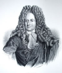
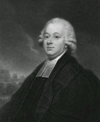
Nautical almanac. In 1766, Nevil Maskelyne compiled the Nautical Almanac, the first accurate nautical tables that provided navigators with the day-to-day positions of celestial bodies necessary for accurate latitude and longitude calculations.
Nevil Maskelyne (1732-1811) was an English astronomer, ordained minister, and author. He is credited with devising a means to measure the density of the earth as well as inventing the prismatic micrometer. His astronomical works included The British Mariners Guide (1763), Philosophical Transactions, and a standard catalog of the stars.
Marine chronometer. Despite the compilation of almanacs and tables to predict the day-to-day positions of celestial bodies and the development of "lunar-distance" techniques, accurate longitudinal readings were not possible until the 18th century when John Harrison invented a precise timekeeping instrument. Known as a portable marine chronometer, it allowed sailors to accurately tell time at sea and thereby more precisely calculate their longitude.
Harrisons invention was motivated in large part by the British Board of Longitude, which in 1713 had posted a reward of 20,000 lira to anyone who developed a timepiece that could keep precise time while at sea. Inaccurate longitudinal calculations had been blamed for a string of deadly maritime disasters during this period. In 1728, Harrison began working on a marine clock known as timepiece No. 1. By 1761, he had perfected a marine chronometer called timepiece No. 4--a five-inch diameter pocket watch. He did not receive the entire, 20,000-lira award until King George III intervened on his behalf in 1773, just three years before the inventors death.
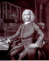 |
| John Harrison 1693-1776. (Photo courtesy of the Science Museum, London, England) |
John Harrison (1693-1776) was an English carpenter, horologist (clock and watchmaker), inventor, and mechanician. In addition to dedicating much of his life to perfecting the marine chronometer, he also constructed clocks and surveying instruments. He is credited with inventing the compound pendulum in 1726. Called the gridiron compensating pendulum, this clock mechanism could self-compensate for error-causing climatic (temperature) changes. Harrison also invented the recoil escapement mechanism and a clock spring mechanism that allowed a clock to continue keeping time while it was being wound.
Top
Parallels
of latitude
Parallels of latitude are the horizontal lines that often appear on maps, charts, and globes. They are also referred to as lines of latitude, latitude lines, or simply parallels. The word latitude--which is often abbreviated as lat.--is a Middle English word derived from the Latin terms latitudo, which meant breadth or width, and latus, which meant broad.
Parallels are
imaginary, equally-spaced, rings that encircle the earths surface in
an east-west fashion. They run perpendicular to meridians of longitude
and parallel to both the equator and each other. Put another way, a line
of latitude cuts across the north-south axis of the earth much like a
knife cuts across the core of an onion as it is sliced.
No matter what their longitudinal coordinates, all locations on a specific parallel have exactly the same latitudinal coordinate. Following this same principle, every location on a specific meridian has a unique and individual latitudinal coordinate. While it is customary for cartographers to show only major parallels, and possibly their major subdivisions, on maps, charts, and globes, there is no set number of parallels: the number of parallels is unlimited.
Since the earth is not a perfect sphere, but is somewhat flattened near its geographic poles, the length of a degree of latitude (or distance between two parallels spaced one degree apart) varies slightly from 68.703 statute miles (110.567 kilometers) at the equator to 69.407 statute miles (111.699 kilometers) at the north and south poles.
Around the 46th parallel in Michigan's Upper Peninsula, one second of latitude equals about 100 feet (while one second of longitude equals about 69 feet).
***Lat/lon diagram adapted from the U.S. Army's Map Reading and Land Navigation Field Manual (FM 3-25.26, rev. 20 July 2001, formerly FM 21-26)
Notable parallels
Top
Arctic
Circle
Located at 66
degrees, 30 minutes north latitude, the arctic circle marks the line of
demarcation between the northern frigid zone, or north polar region, and
the northern temperate zone. This imaginary circle around the earth also
marks the point north of which the sun is not visible every day of the
year. Situated about 1,624 miles from the geographic north pole, this
parallel of latitude passes through Alaska, Canada, Greenland, the northern
Atlantic Ocean, Norway, Sweden, Finland, Russia, and the Bering Sea.
Top
Tropic of Cancer
Located at 23 degrees, 27 minutes north latitude, the Tropic of Cancer marks the northern limit of the earths tropical--or torrid--zone. This imaginary line around the earth--or parallel of latitude--passes through the North Pacific Ocean, Mexico, the Gulf of Mexico, the Bahamas, the northern Atlantic Ocean, the Western Sahara, Mauritania, Mali, Algeria, Libya, Egypt, the Red Sea, Saudi Arabia, the United Arab Emirates, Oman, the Arabian Sea, India, Bangladesh, Myanmar, China, the South China Sea, and Taiwan.
Cancer. The Tropic of Cancer takes its name from the Cancer constellation, which occupies a 30-degree-segment of the 18-degree-wide zodiacal constellation--a swath of the heavens, known as the elliptic, that the sun traverses annually. The Cancer constellation is the fourth of 12 zodiacal constellations. This extremely faint, spring constellation is located in the equatorial region of the northern hemisphere, directly overhead, between Gemini and Leo. This constellation is also known as the Crab since the English term Cancer is derived from the Latin word Cancer, which means Crab.
Summer solstice. The Tropic of Cancer represents the northernmost point, north of the equator, where the sun appears directly overhead. When this occurs at noon on June 20, 21, or 22 of each year, it marks the arrival of the summer solstice and the longest day of the year in its hemisphere. The summer solstice represents the start of summer in the northern hemisphere (and winter in the southern hemisphere) and is sometimes referred to as the June solstice. The English word solstice is derived from the Latin term solstitium, which originated from the Latin terms sol and stit, meaning "sun" and "to stop or make stand," respectively, which is what the sun appears to do on that day.
***Lat/lon diagram adapted from the U.S. Army's Map Reading and Land Navigation Field Manual (FM 3-25.26, rev. 20 July 2001, formerly FM 21-26)
Top
Equator
Located at zero degrees latitude, the equator represents the imaginary line around the earth--or parallel of latitude--that lies an equal distance from both the geographic north and south poles. It serves to divide the earth into two hemispheres: the southern and northern. Measuring about 24,901 miles in length, the equator passes through the Pacific Ocean, Ecuador, Columbia, Brazil, the Atlantic Ocean, Gabon, the Congo, Zaire, Uganda, Kenya, Somalia, the Indian Ocean, and Indonesia.
Top
Tropic
of Capricorn
Located at 23 degrees, 27 minutes south latitude, the Tropic of Capricorn marks the southern limit of the earths tropical--or torrid--zone. This imaginary line around the earth--a parallel of latitude--passes through the southern Pacific Ocean, Chile, Argentina, Paraguay, Brazil, South Atlantic Ocean, Namibia, Botswana, South Africa, Mozambique, Indian Ocean, Madagascar, Indian Ocean, and Australia.
Capricorn. The Tropic of Capricorn, or Capricornus, takes its name from the 30-degree-long Capricorn constellation, which is the tenth of 12 zodiacal constellations situated in an 18-degree-wide swath of the heavens--known as the elliptic--that the sun traverses annually. Also known as the Sea Goat or Horned Goat, this faint, autumn constellation is located in the equatorial region of the southern hemisphere, directly overhead, between Aquarius and Sagittarius. The English term Capricorn is derived from the Latin term Capricornus, which originated from the Latin terms caper and cornu, meaning "goat" and "horn," respectively.
Winter solstice. The Tropic of Capricorn represents the southernmost point, south of the equator, where the sun appears directly overhead. When this occurs at noon on December 21 or 22 of each year, it marks the arrival of the winter solstice and the shortest day of the year in the northern hemisphere. The winter solstice represents the start of winter in the northern hemisphere (and summer in the southern hemisphere) and is sometimes referred to as the December solstice. The English word solstice is derived from the Latin term solstitium, which originated from the Latin terms sol and stit, meaning "sun" and "to stop or make stand," respectively, which is what the sun appears to do on that day.
Top
Antarctic
Circle
Located at 66 degrees, 30 minutes south latitude, the antarctic circle marks the line of demarcation between the southern frigid zone, or south polar region, and the southern temperate zone. This imaginary circle around the earth also marks the point south of which the sun is not visible every day of the year. Situated about 1,624 miles from the geographic south pole, this imaginary line around the earth--or parallel of latitude--passes through the ice-encrusted continent of Antartica as well as the Southern Ocean, or the Antarctic Ocean.
Top
Latitudinal
coordinates
A specific locations latitudinal coordinate is its northerly, or southerly, angular distance along the earths surface relative to the equator. It is measured as an arc, along a meridian of longitude, perpendicular to the equator, which is by convention the zero degree parallel.
The numerical coordinate
Latitudinal coordinates--which
can range up to one-quarter of the earths circumference, from zero degrees
(at the equator) to 90 degrees (at the north, or south, terrestrial poles)--are
angles traditionally expressed in a degrees-minutes-seconds format: 45°
30 30.30"N. By custom, degree units are signified by the degree
° symbol; minutes are signified by the
minutes symbol, a single tick mark or apostrophe; and seconds are signified
by the seconds " symbol, or a double tick mark or quotation mark.
In the degree-based latitude and longitude measurement system, a circle
is made up of 360 degrees; a degree is made up of 60 minutes (a minute
equals 1/60 of a degree); and a minute is made up of 60 seconds (a second
equals 1/60 of a minute, or 1/3600 of a degree).
In addition to a "degrees, minutes, seconds" format, latitudinal coordinates are sometimes expressed in shortened forms such as a "degrees and minutes" format, where the parts of a minute are represented in a decimal-fraction form (e.g., 45° 30.5001N), or a "degrees" format, where the parts of a degree are represented in decimal-fraction form (e.g., 45.5084166° N).
While decimal-fraction format coordinates are a common coordinate format option in Global Positioning System (GPS) units and mapping software programs, they are very cumbersome for plotting on topographic maps, especially in the field. Information on how to convert latitude/longitude coordinates from one format to another, or convert them to or from the UTM coordinate system, is discussed below.
***Lat/lon diagram adapted from the U.S. Army's Map Reading and Land Navigation Field Manual (FM 3-25.26, rev. 20 July 2001, formerly FM 21-26)
The hemispherical designator
Latitudinal coordinates are typically followed by a single letter or symbol that designates whether they are located north of the equator--in the northern hemisphere--or south of the equator--in the southern hemisphere. North latitudinal coordinates are customarily followed by either the letter "N" or the plus "+" symbol. South latitudinal coordinates are customarily followed by either the letter "S" or the minus "-" symbol.
Since the continental United States lies entirely within the northern hemisphere for latitudinal purposes, many U.S. maps and charts do not include a northern hemisphere designator with the latitudinal coordinates printed along the neatlines in the margins of the map or chart. Cartographers assume the user will know the latitudinal coordinate is in the northern hemisphere.
By convention, latitude/longitude coordinate combinations always list the latitudinal coordinate first and the longitudinal coordinate second.
Top
Meridians
of longitude
Meridians of longitude
are the vertical lines that often appear on maps, charts, and globes.
They are also referred to as lines of longitude, longitudinal lines, meridians
of longitude, geographic meridians, or simply meridians. The word longitude--which
is often abbreviated as lon. or long.--is a Middle English word derived
from the Latin terms longitudo, which meant length, and longus,
which meant long.
Meridians are the imaginary, equally-spaced, half-circles that are drawn on the earth's surface in a north-south fashion, from pole to pole. They run perpendicular to the parallels of latitude. All meridians converge at the north and south geographic poles. Put another way, a line of longitude cuts through the north-south axis of the earth much like a knife cuts through the core of an apple when it is sliced.
No matter what their latitudinal coordinates, all locations on a specific meridian have exactly the same longitudinal coordinate. Following this same principle, every location on a specific parallel has a unique and individual longitudinal coordinate. While it is customary for cartographers to show only major meridians, and possibly their major subdivisions, on maps, charts, and globes, there is no set number of meridians: the number of meridians is unlimited.
The length of a degree of longitude (or width between two meridians spaced one degree apart) varies depending on the location and is a function of the cosine of its latitude. At the equator--or the zero parallel at zero degrees latitude--where the lines of longitude are their furthest apart, one degree of longitude measures 69.172 statue miles (111.321 kilometers). Near the middle of the Lower Peninsula of Michigan--or the 45th parallel at 45 degrees north latitude--one degree of longitude measures 48.995 statute miles (78.849 kilometers). At the north geographic pole--or the 90th parallel at 90 degrees north latitude--all the lines of longitude converge and one degree of longitude measures 0.000 statute miles (0.000 kilometers).
Around the 46th parallel in Michigan's Upper Peninsula, one second of longitude equals about 69 feet (while one second of latitude equals about 100 feet).
***Lat/lon diagram adapted from the U.S. Army's Map Reading and Land Navigation Field Manual (FM 3-25.26, rev. 20 July 2001, formerly FM 21-26)
Notable meridians
Top
The
prime meridian
The prime meridian
is defined as the meridian from which all of the earths other meridians
are reckoned or measured. It is also known as the Greenwich Meridian,
meridian of Greenwich, zero meridian, first meridian, standard meridian,
reference meridian, or base meridian.
By modern convention, the prime meridian--the zero-degree, north-south line of longitude--is defined as the meridian that passes through the optical axis (crosshairs) of the Airy Transit Circle telescope at the old Royal Greenwich Observatory located in Greenwich, England. The coordinates of the Airy transit are 51° 28 38.1" north latitude and 000° 00 00" longitude.
Greenwich is a residential and industrial borough of east-central Greater London. It is situated along the south bank of the 210-mile-long River Thames, which is locally known as the London River.
The Royal Greenwich Observatory, originally known as the Observatory of Greenwich, was located in Greenwich from 1675 until the 1950s when light pollution from the Greater London area limited the observatorys astronomical effectiveness and forced its relocation to Hurstmonceux Castle, a village located in Englands East Sussex County. In 1990, the observatory was moved to Cambridge where it remained operational until its closure in 1998.
Prior to 1884, the location of the prime meridian varied from country to country. Nations often designated their capital (e.g., Washington, Paris, Madrid, Copenhagen, Rome, Beijing, etc.) as the location of the prime meridian, and it became known as their national meridian. Sometimes convenient location or historic sites--such as the Canary Islands--were designated as an areas prime meridian.
To eliminate the problems multiple prime meridians created for timekeeping, cartography, and navigation, the Washington Meridian Conference was held in Washington, D.C. in 1884. The result of this international meeting was a treaty that fixed the official location for the earths prime meridian as "the meridian passing through the centre of the transit instrument" at the United Kingdoms Royal Astronomical Observatory located in Greenwich, England.
Time zones and the prime meridian
In addition to being the geographical location of the modern-day prime meridian, Greenwich, England also serves as the place from which Greenwich Mean Time (GMT)--the world timekeeping standard and basis for the worlds time zone system--is calculated. Greenwich Mean Time is also known as Universal Time.
Each of the worlds 24 time zones occupies a 15-degree slice of longitude. Time zones west of the Greenwich zone have times that are progressively earlier--one hour earlier per each time zone--the farther they are located west of the Greenwich zone. Time zones east of the Greenwich zone have times that are progressively later--one hour later per time zone--the farther they are located east of the Greenwich zone.
Put another way, every second, the earth rotates through 15 seconds of longitude; every minute, the earth rotates through 15 minutes of longitude; every hour, the earth rotates through 15 degrees of longitude; and every 24 hours, the earth rotates through 360 degrees of longitude, or one complete revolution.
***Lat/lon diagrams adapted from the U.S. Army's Map Reading and Land Navigation Field Manual (FM 3-25.26, rev. 20 July 2001, formerly FM 21-26)
Top
International
Date Line
The International
Date Line, sometimes simply known as the date line, is an irregular, imaginary
line running between the north and south geographical poles. This north-south-running
line is largely represented by the 180 degree east longitude meridian,
or the 180 degree west longitude meridian, both of which are situated
180 degrees opposite the prime meridian. The current location of the International
Date Line was officially agreed upon when the position of the prime meridian
was established in 1884 at the Washington Meridian Conference in Washington,
D.C.
While the location of the date line generally follows the 180-degree meridian, it does depart to the east or west in certain areas to prevent landmasses, islands, or archipelagos from straddling the dateline and having two different dates, a situation that would seriously disrupt an areas daily life and commerce. Starting from the arctic circle, the International Date Line diverges eastward from the 180th meridian to avoid splitting Russias Siberia near it eastern border; westward to avoid splitting the Aleutian Islands from Alaska in the United States; and westward again to avoid splitting the Fiji Islands and to avoid separating New Zealand from it smaller islands.
As the worlds official date line, the 180th meridian marks the location on the earths surface where the date changes, where one day ends and the next day begins. This occurs when the sun is directly over the prime meridian, which is located on the opposite side of the earth at the zero degree line of longitude. Locations just west of the International Date Line are one day ahead of points just east of it.
***Lat/lon diagrams adapted from the U.S. Army's Map Reading and Land Navigation Field Manual (FM 3-25.26, rev. 20 July 2001, formerly FM 21-26)
Top
Longitudinal
coordinates
A specific locations longitudinal coordinate is its easterly or westerly angular distance along the earths surface relative to the prime meridian. It is measured as an arc, along a parallel of latitude, perpendicular to the prime meridian, which by modern convention is the zero degree meridian.
The numerical coordinate
Longitudinal coordinates--which
can range up to one-half of the earths circumference, from zero degrees
(at the prime meridian) to 180 degrees (at the international date line)--are
angles traditionally expressed in a degrees-minutes-seconds format: 145°
30 30.30"W. By custom, degree units are signified by the degree
° symbol; minutes are signified by the
minutes symbol, a single tick mark or apostrophe; and seconds are signified
by the seconds " symbol, or a double tick mark or quotation mark.
In the degree-based latitude and longitude measurement system, a circle
is made up of 360 degrees; a degree is made up of 60 minutes (a minute
equals 1/60 of a degree); and a minute is made up of 60 seconds (a second
equals 1/60 of a minute, or 1/3600 of a degree).
In addition to a "degrees, minutes, seconds" format, latitudinal coordinates are sometimes expressed in shortened forms such as a "degrees and minutes" format, where the parts of a minute are represented in a decimal-fraction form (e.g., 145° 30.5001W), or a "degrees" format, where the parts of a degree are represented in decimal-fraction form (e.g., 145.5084166° W).
While decimal-fraction format coordinates are a common coordinate format option in Global Positioning System (GPS) units and mapping software programs, they are very cumbersome for plotting on topographic maps, especially in the field. Information on how to convert latitude/longitude coordinates from one format to another, or convert them to or from the UTM coordinate system, is discussed below.
***Lat/lon diagram adapted from the U.S. Army's Map Reading and Land Navigation Field Manual (FM 3-25.26, rev. 20 July 2001, formerly FM 21-26)
The hemispherical designator
Longitudinal coordinates are typically followed by a single letter or symbol that designates whether they are located east of the prime meridian--in the eastern hemisphere--or west of the prime meridian--in the western hemisphere. West longitudinal coordinates are customarily followed by either the letter "W" or the plus "+" symbol. East longitudinal coordinates are customarily followed by either the letter "E" or the minus "-" symbol. Note: Some lat/lon coordinate systems use the minus symbol to designate westerly coordinates and the plus symbol to designate easterly coordinates.
Since the continental United States lies entirely within the western hemisphere for longitudinal purposes, many U.S. maps and charts do not include a western hemisphere designator with the longitudinal coordinates printed along the neatlines in the margins of the map or chart. Cartographers assume the user will know the longitudinal coordinate is in the western hemisphere.
By convention, latitude/longitude coordinate combinations always list the latitudinal coordinate first and the longitudinal coordinate second.
Top
Calculating
& plotting
lat/lon coordinates on maps
Learning how to plot lat/lon coordinates--identify the specific location the coordinates refer to on a map--and calculate lat/lon coordinates--figure out what the coordinates are for a specific location on a map--can be an valuable skill for advanced-level wilderness trippers.
For example, sometimes wilderness trippers will be given coordinates in a lat/lon format only and it will be necessary to either use them as they are or convert them to another format. At other times, wilderness trippers will find themselves using maps or charts--especially NOAA nautical charts used by sea kayakers--that only include the lat/lon coordinate grid system.
On the majority of maps, the perimeter boundary lines--called neatlines--along the left and right sides and the tops and bottoms are represented by lines of longitude and lines of latitude, respectively. However, many maps, especially large-scale topographic maps suitable for wilderness land navigation, dont come preprinted with a grid of such lines--called a graticule--across the interior of the map.
Topographic maps are often called quadrangles--or quads--because they represent four-sided polygons known as quadrilaterals. While it may not be readily apparent, a quad does not form a true rectangle--a parallelogram composed of four right angles--because, unlike the parallels of latitude that run parallel to each other as they form the top and bottom of a map, the meridians of longitude that form the left and right sides of the map are not straight lines and they don't run parallel to each other. Instead, the meridians of longitude bend ever so slightly as they converge at the poles.
Top
Drawing
the lat/lon grid
Before a map can be used with the latitude/longitude geographic coordinate system, a grid of parallels and meridians should be overlaid on the map proper. Since most maps include a series of tick or hash marks--known as graticule marks--along the neatlines in all four margins, and sometimes within the interior of the map itself in the form of small crosses or plus "+" sign symbols, the user can simply draw the parallels and meridians across the surface of the map by using a pencil and a straightedge, such as an aluminum yardstick, to connect these preprinted marks.
In the field, lines of latitude and longitude can be drawn across a map by simply folding a corresponding map edge over onto the surface of the map to create an improvised straight edge.
Top
Using a lat/lon
coordinate plotter
To calculate the latitude/longitude coordinates for a specific location on a map, or to plot known latitude/longitude coordinates--say from a GPS unit--on a map, a latitude/longitude plotter should be used.
Commercially manufactured latitude/longitude plotters, calibrated in minutes and seconds, can be purchased from a number of sources, some of which are listed below. Homemade plotters and improvised, field-expedient latitude/longitude plotters can also be fashioned as described below.
While it is possible to calculate or plot approximate latitudinal and longitudinal coordinates without a plotter through interpolation--estimating coordinates or their plots using a proportional, geometric technique--it is often much more complicated and time-consuming, not to mention less accurate, than using a latitude/longitude coordinate plotter.
To use a latitude/longitude coordinate plotter, simply position the device so each end of the appropriate scale is aligned between two, adjacent lines of latitude, or longitude, depending on which coordinate is being calculated or plotted. Often, especially when plotting longitudinal coordinates, the scale will have to be positioned at an angle between the lines, not perpendicularly, as is the custom when using most conventional rulers.
For Michigan, Canadian, and other North American quads, latitudinal coordinates increase from bottom to top, or from south to north; longitudinal coordinates increase from right to left, or from east to west.
The number of divisions on a latitude/longitude plotter often depends on the map scale for which it was designed. For example, The Coordinator, a commercial latitude/longitude plotter, is configured with the following scales:
- 1:24,000 plotter (7 & 9/16 inches long)--150 one-second divisions for grid lines spaced up to 2 minutes, 30 seconds apart.
- 1:25,000 plotter (7 & 1/4 inches long)--150 one-second divisions for grid lines spaced up to 2 minutes, 30 seconds apart
- 1:30,000 plotter (6 & 1/16 inches long)--150 one-second divisions for grid lines spaced up to 2 minutes, 30 seconds apart
- 1:50,000 plotter (7 & 1/4 inches long)--300 one-second divisions for grid lines spaced up to 5 minutes, 00 seconds apart
- 1:62,500 plotter (5 & 13/16 inches long)--300 one-second divisions for grid lines spaced up to 5 minutes, 00 seconds apart
- 1:63,360 plotter (5 & 3/4 inches long)--300 one-second divisions for grid lines spaced up to 5 minutes, 00 seconds apart
- 1:100,000 plotter (11 inches long)--450 two-second divisions for grid lines spaced up to 15 minutes, 00 seconds apart
- 1:250,000 plotter (4 & 3/8 inches long)--180 five-second divisions for grid lines spaced up to 15 minutes, 00 seconds apart
Once one coordinate is calculated, or plotted, depending on the case, the latitude/longitude plotter can then be repositioned to calculate, or plot, the remaining coordinate. While a single plotter works well for calculating the coordinates of a fixed position on a map, two plotters, used simultaneously--one to plot the latitudinal coordinate and one to plot the longitudinal coordinate--are handy for plotting a known coordinate--say from a GPS unit--on a map.
Since calculating and/or plotting latitudinal and longitudinal coordinates on topographical maps in the bush is a rather cumbersome and complicated process (due in large part to the non-symmetrical nature of the graticule), most experienced, long-range, wilderness trippers avoid this awkward system and instead rely on the easy-to-use Universal Transverse Mercator (UTM) coordinate system for rapid, on-the-go geographical calculations and plots.
Top
Commercial
lat/lon &
UTM coordinate plotter vendors
Ben Meadows Company
1-800-241-6401Brooks-Range Mountaineering Equipment Co.
1-718-585-1717Brunton Company
1-800-443-4871
See "map quad tool"Forestry Suppliers, Inc.
1-800-647-5368Lat.26Inc
1-800-305-0036The Map Store
1-877-921-6277Map Tools
1-650-529-9410Mountains Plus
1-877-411-4327Ranger Joe's
1-800-247-4541Search Gear
1-800-474-2612Waypoint Enterprises
1-888-412-2600
Improvised lat/lon plotters
Top
1:20,000 (5.4
by 8) Ontario quads
The quad. The Ontario Ministry of Natural Resources 1:20,000-scale quad is a topographic base map published by the Province of Ontario, Canada. This 19.75-inch-wide by 19.75-inch-high map depicts 5.4 minutes of latitude and 8 minutes of longitude. Since the majority of these maps are not configured with latitudinal and longitudinal tick marks, most are not suitable for use with the latitude/longitude coordinate system.
Some of the older 1:20,000-scale quads have graticule tick marks placed at two minute--or 120 second--intervals. The neatlines along the maps boundaries, however, do not correspond with the parallels and meridians needed for use with the latitude/longitude coordinate system. Instead, they represent the easting and northing lines necessary for use with the Universal Transverse Mercator (UTM) system,.
Top
1:24,000 (7.5
by 7.5) USGS quads
The quad. The USGS 1:24,000-scale quad is the most common topographic map in Michigan. This 15.75-inch-wide by 22.75-inch-high map depicts 7.5 minutes of latitude and 7.5 minutes of longitude. Because of its 7.5-minute size, it is often referred to as a 7.5-minute quad.
Lat/lon tick marks. On the 1:24,000-scale quad, the latitude and longitude coordinate system tick marks are located on the neatlines in all four of the maps margins. As an aid to drawing lines between these marginal tick marks, corresponding crosses, or plus "+" sign symbols, often appear between the neatlines, within the map proper. Typically, these graticule tick marks are placed at 2.5-minute--or 150 second--intervals. Since the latitude/longitude coordinate system is not symmetrical, 2.5 minutes of latitude equals about 7.5 inches while 2.5 minutes of longitude equals about 5.25 inches.
Improvising
a plotter. To improvise a latitude/longitude coordinate plotter for
a 1:24,000-scale quad in the field, simply cut off a 1-inch-wide by 9-inch-long,
ruler-shaped piece of the maps blank margin. Using the statute-mile scale
in the maps bottom margin, measure off and mark 30, 1/10-of-a-mile increments
(which should total exactly 3 miles) along one edge of the improvised
paper ruler as shown in the following diagram. 
Each one of these 0.1-mile segments will correspond with 5 seconds of latitude, or longitude, depending upon which coordinate the ruler is used to measure. Similarly, 12 of these 0.1-mile segments will correspond with one minute of latitude, or longitude.
Once the ruler is marked off in 0.1-mile segments, label the first two 12-segment sections (measuring 1.2 miles and representing 60 seconds--or 1 minute--each) with the second designators of 0, 5, 10, 15, 20, 25, 30, 35, 40, 45, 50, 55, and 60 (the 60 would also correspond with the zero starting mark of the next segment). Once these two, 12-segment sections--measuring 1.2 miles each and representing 60 seconds (or 1 minute) each--have been marked off, mark off the remaining 6-segment section (measuring 0.6 miles and representing 30 seconds) with the second designators of 0, 5, 10, 15, 20, 25, and 30.
Using the plotter. To calculate or plot a latitudinal (or longitudinal) coordinate with this improvised ruler, simply align the zero mark on the ruler with the lower or southernmost line of latitude (or right or easternmost line of longitude) and then angle the opposite end of the ruler until the 30th mark--the 2.5-minute (150-second) mark--lines up with the adjacent upper or northern line of latitude (or the adjacent line of longitude to the left or west), which should be located 2.5 minutes away. Because of the non-symmetrical nature of the latitude/longitude coordinate system, this improvised plotter is designed to be used at an angle between two lines of latitude (or longitude), not perpendicularly.
Top
1:25,000 (7.5
by 7.5) USGS quads
The quad. The USGS 1:25,000-scale quad is a less common topographic map in Michigan. This 15-inch-wide by 21.75-inch-high map depicts 7.5 minutes of latitude and 7.5 minutes of longitude. Like the 1:24,000-scale quad, this map is often referred to as a 7.5-minute quad.
Lat/lon tick marks. On the 1:25,000-scale quad, the latitude and longitude coordinate system tick marks are located on the neatlines in all four of the maps margins. As an aid to drawing lines between these marginal tick marks, corresponding crosses, or plus "+" sign symbols, often appear between the neatlines, within the map proper. Typically, these graticule tick marks are placed at 2.5-minute--or 150 second--intervals. Since the latitude/longitude coordinate system is not symmetrical, 2.5 minutes of latitude equals about 7.25 inches while 2.5 minutes of longitude equals about 5.25 inches.
Improvising a plotter. (Note: A 1:24,000-scale quad plotter will work on 1:25,000-scale quads.) To improvise a latitude/longitude coordinate plotter for a 1:24,000-scale quad in the field, simply cut off a 1-inch-wide by 9-inch-long, ruler-shaped piece of the maps blank margin. Using the statute-mile scale in the maps bottom margin, measure off 30, 1/10-of-a-mile increments (which should total exactly 3 miles) along one edge of the improvised paper ruler (see diagram in the 1:24,000 plotter instructions above).
Each one of these 0.1-mile segments will correspond with 5 seconds of latitude, or longitude, depending upon which coordinate the ruler is used to measure. Similarly, 12 of these 0.1-mile segments will correspond with one minute of latitude, or longitude.
Once the ruler is marked off in 0.1-mile segments, label the first two 12-segment sections (measuring 1.2 miles and representing 60 seconds--or 1 minute--each) with the second designators of 0, 5, 10, 15, 20, 25, 30, 35, 40, 45, 50, 55, and 60 (the 60 would also correspond with the zero starting mark of the next segment). Once these two, 12-segment sections--measuring 1.2 miles each and representing 60 seconds (or 1 minute) each--have been marked off, mark off the remaining 6-segment section (measuring 0.6 miles and representing 30 seconds) with the second designators of 0, 5, 10, 15, 20, 25, and 30.
Using the plotter. To calculate or plot a latitudinal (or longitudinal) coordinate with this improvised ruler, simply align the zero mark on the ruler with the lower or southernmost line of latitude (or right or easternmost line of longitude) and then angle the opposite end of the ruler until the 30th mark--the 2.5-minute (150-second) mark--lines up with the adjacent upper or northern line of latitude (or the adjacent line of longitude to the left or west), which should be located 2.5 minutes away. Because of the non-symmetrical nature of the latitude/longitude coordinate system, this improvised plotter is designed to be used at an angle between two lines of latitude (or longitude), not perpendicular to the edges of the map.
Top
1:50,000 (15
by 30) Canadian quads
The quad. The Canadian 1:50,000-scale quad is the most common topographic map in Canada. This 30-inch-wide by 21.75-inch-high map depicts 15 minutes of latitude and 30 minutes of longitude.
Lat/lon tick marks. On the 1:50,000-scale quad, the latitude and longitude coordinate system tick marks are located on the neatlines in all four of the maps margins. There are normally no intermediate tick marks within the map proper. Typically, these graticule tick marks are placed at 5-minute--or 300 second--intervals. For convenience, the neatlines on the 1:50,000-scale quads also include a handy, checkered border that readily denotes each intermediate minute of latitude and longitude. Since the latitude/longitude coordinate system is not symmetrical, 5 minutes of latitude equals about 7.25 inches while 5 minutes of longitude equals about 5 inches.
Improvising a plotter. To improvise a latitude/longitude coordinate plotter for a 1:50,000-scale quad in the field, simply cut off a 1-inch-wide by 9-inch-long, ruler-shaped piece of the maps blank margin. Using the statute-mile scale in the maps bottom margin, measure off 30, 2/10-of-a-mile increments (which should total exactly 6 miles) along one edge of the improvised paper ruler (see diagram in the 1:24,000 plotter instructions above).
Each one of these 0.2-mile segments will correspond with 10 seconds of latitude, or longitude, depending upon which coordinate the ruler is used to measure. Similarly, 6 of these 0.2-mile segments will correspond with one minute of latitude, or longitude.
Once the ruler is marked off in 0.2-mile segments, label all five 6-segment sections (measuring 1.2 miles and representing 60 seconds--or 1 minute--each) with the second designators of 0, 10, 20, 30, 40, 50, and 60 (the 60 would also correspond with the zero starting mark of the next segment).
Using the plotter. To calculate or plot a latitudinal (or longitudinal) coordinate with this improvised ruler, simply align the zero mark on the ruler with the lower or southernmost line of latitude (or right or easternmost line of longitude) and then angle the opposite end of the ruler until the 30th mark--the 5-minute (300-second) mark--lines up with the adjacent upper or northern line of latitude (or the adjacent line of longitude to the left or west), which should be located 5 minutes away. Because of the non-symmetrical nature of the latitude/longitude coordinate system, this improvised plotter is designed to be used at an angle between two lines of latitude (or longitude), not perpendicularly.
Top
Lat/lon format
conversion
Converting between different formats in the latitude/longitude geographical coordinate system is a somewhat complicated process since the system uses degree-based measurements. As such, it requires making computations based not on multiples of 10, to which we are accustomed, but on multiples of 60.
For example, in the degree-based, latitude and longitude measurement system, a circle is made up of 360 degrees; a degree is made up of 60 minutes (a minute equals 1/60 of a degree); and a minute is made up of 60 seconds (a second equals 1/60 of a minute, or 1/3600 of a degree).
To make in-the-field decimal-format conversions easier, keep the following equivalents in mind:
15 minutes = 1/4 of a (hour) degree, which is 0.25 degrees
30 minutes = 1/2 of a (hour) degree, which is 0.50 degrees
45 minutes = 3/4 of a (hour) degree, which is 0.75 degrees15 seconds = 1/4 of a minute, which is 0.25 minutes
30 seconds = 1/2 of a minute, which is 0.50 minutes
45 seconds = 3/4 of a minute, which is 0.75 minutes
Latitudinal and longitudinal coordinates in a format other than "degrees, minutes, seconds"--such as where the degrees or minutes are expressed with decimal fractions--are very difficult to plot on maps. This is one of the reasons why many experienced wilderness trippers prefer to work with the Universal Transverse Mercator (UTM) coordinate system.
Lat/lon & UTM coordinate
format conversion Web sites
Top
Lat/lon to lat/lon
format converters
Montana State Library
Latitude Longitude Conversion Application
http://nris.state.mt.us/wis/location/latlong.aspJeep.Com
Coordinate Translation Page
http://jeeep.com/details/coord/
Top
Lat/lon to UTM
format converters
Jeep.Com
Coordinate Translation Page
http://jeeep.com/details/coord/Montana State Library
Graphical Locator: XY-Data (DMS) Page
http://www.esg.montana.edu/gl/xy-data2.htmlU.S. Department of Commerce
National Geodetic Survey
NGS Geodetic to UTM Page
http://www.ngs.noaa.gov/cgi-bin/utm_getut.prlOasis.com
Coordinate Converter Page
http://www.gpsinformation.net/
Top
UTM to lat/lon
format converters
Jeep.Com
Coordinate Translation Page
http://jeeep.com/details/coord/Montana State Library
Graphical Locator: XY-Data (UTM) Page
http://www.esg.montana.edu/gl/xy-data3.htmlU.S. Department of Commerce
National Geodetic Survey
NGS UTM to Geodetic Page
http://www.ngs.noaa.gov/cgi-bin/utm_getgp.prlOasis.com
Coordinate Converter Page
http://www.gpsinformation.net/
Top
Downloadable
format conversion utilities
U.S. Department of Commerce
National Geodetic Survey
NGS Geodetic Tool Kit Page
http://www.ngs.noaa.gov/TOOLS/
Offers UTM, LAT/LON, & USNG conversion utilitiesNational Geospatial-Intelligence Agency
GeoTrans Translator
http://earth-info.nga.mil/GandG/geotrans/
GeoTrans utility converts wide array of coordinate formats
Top
Lat/lon &
UTM coordinate
format conversion via a GPS unit
A Global Positioning System (GPS) unit can be used to convert latitude and longitude coordinates from one format to another. Simply set the coordinate format display (go to system setup menu) of your GPS unit to the format of your coordinates and input your coordinates. Then set the coordinate format display of your GPS unit to the desired coordinate display format and read the conversion from it.
Lat/lon to lat/lon
format
manual conversion formulas
Top
DEG-MIN-SEC
to DEG-MIN
Convert "degrees, minutes, seconds" format (e.g., 45°
30 30.31"N)
to "degrees, decimal minutes" format (e.g., 45°
30.5052N):
Objective: convert 45° 30' 30.31"N to "degree, decimal minutes" format
Step 1: "degrees" (45°) remains unchanged
Step 2: "decimal minutes" = minutes + (seconds/60)
"decimal minutes" = 30 + (30.31/60) = 30.5052'
Result: "degree, decimal minutes" format = 45° 30.5052N
Top
DEG-MIN-SEC
to DEG
Convert "degrees, minutes, seconds" format (e.g., 45°
30 30.31"N)
to "decimal degrees" format (e.g., 45.5084194°
N)
TopObjective: convert 45° 30 30.31"N to "decimal degrees" format
Step 1: "decimal degrees" = degrees + (minutes/60) + (seconds/3600)
"decimal degrees" = 45 + (30/60) + (30.31/3600) = 45.5084194°
Result: "decimal degrees" = 45.5084194°
DEG-MIN to DEG
Convert "degrees, decimal minutes" format (e.g., 45° 30.5052N)
to "decimal degrees" format (e.g., 45.5084° N):
Objective: convert 45° 30.5052N to "decimal degrees" format
Step 1: "decimal degrees" = degrees + (minutes/60)
"decimal degrees" = 45 + (30.5052/60) = 45.5084°
Result: "decimal degrees" = 45.5084°
Top
DEG-MIN to DEG-MIN-SEC
Convert "degrees,
decimal minutes" format (e.g., 45°
30.5052N)
to "degrees, minutes, seconds" format (e.g., 45°
30 30.31"N):
Objective: convert 45° 30.5052N to "degrees, minutes, seconds" format
Step 1: "degrees" (45°) remains unchanged
Step 2: "minutes" = MM.mmmm - 00.mmmm
"minutes" = 30.5052 - 00.5052 = 30
Step 3: "seconds" = 00.mmmm * 60
"seconds" = 00.5052 * 60 = 30.31"
Result: "degrees, minutes, seconds" format = 45° 30' 30.31"N
Top
DEG
to DEG-MIN
Convert "decimal degrees" format (e.g., 45.5084°N)
to "degrees, decimal minutes" format (e.g., 45°
30.5040N):
Objective: convert 45.5084°N to "degrees, decimal minutes" format
Step 1: "degrees" = DD.dddd - 00.dddd
"degrees" = 45.5084 - 00.5084 = 45°
Step 2 : "decimal minutes" = 00.dddd * 60
"decimal minutes" = 00.5084 * 60 = 30.5040
Result: "degrees, decimal minutes" format = 45° 30.5040'N
Top
DEG to DEG-MIN-SEC
Convert "decimal degrees" format (e.g., 45.5084°
N)
to "degrees, minutes, seconds" format (e.g., 45°
30' 30.24"N):
Objective: convert 45.5084°N to "degrees, minutes, seconds" format
Step 1: "degrees" = DD.dddd - 00.dddd
"degrees" = 45.5084 - 00.5084 = 45°
Note: the "decimal minutes" figure must be calculated first in order to calculate the "minutes" figure
Step 2 : "decimal minutes" = 00.dddd * 60
"decimal minutes" = 00.5084 * 60 = 30.5040
Step 3: "minutes" = MM.mmmm - 00.mmmm
"minutes" = 30.5040 - 00.5040 = 30
Step 4: "seconds" = 00.mmmm * 60
"seconds" = 00.5040 * 60 = 30.24"
Result: "degrees, minutes, seconds" format = 45° 30' 30.24"N
Top
Lat/lon
look-up Web sites
Lat/lon lookup by place-name:
USGS: Geographic Names Information System (GNIS)
http://geonames.usgs.gov/index.html
Lists latitude and longitude for 2 million place-names
and features in the United States.Come to Bali
http://www.indo.com/distance/
Lists latitude and longitude by city place-name
Latitude/longitude lookup by zip code or place-name:
ZipInfo.com
http://www.zipinfo.com/search/zipcode.htm
Lists latitude and longitude for zip codes or place-names
Top
References
 |
|
Map Use: Reading,
Analysis, and Interpretation,
fifth edition, by Phillip C. Muehrcke and Juliana O. Muehrcke (Madison,
Wisconsin: JP Publications, 2005)
|
Analytical and Computer Cartography, by Keith C. Clarke (Englewood Cliffs, New Jersey: Prentice Hall, 1990)
Applied Cartography: Source Materials for Mapmaking, by Thomas D. Rabenhorst and Paul D. McDermott (Columbus Ohio: Merrill Publishing Co., 1989)
ArcGIS 9: Understanding Map Projections, by Melita Kennedy (Redlands, California: Environmental Systems Research Institute [ESRI], 2004)
Basic GIS Coordinates, by Jan Van Sickle (Boca Raton, Florida: CRC Press LLC, 2004)
Basic Land Navigation (NFES 2865), by Mary Bogens, Michael Durfee, Lee Gardner, and Richard Streeper (Boise, Idaho: National Interagency Fire Center, Fire Training, 2007)
Coastlines: How Mapmakers Frame the World and Chart Environmental Change, by Mark Monmonier (Chicago, Illinois: University of Chicago Press, 2008)
Compass and Map Navigator: The Complete Guide to Staying Found, revised edition by Michael Hodgson (Guilford, Connecticut: The Globe Pequot Press, 2000)
The Complete Guide to Orienteering in North America: A Comprehensive Manual for the Outdoorsman, by Berndt Berglund (Toronto, Canada: Pagurian Press, 1979)
The Complete Idiot's Guide to Geocaching, by Jack W. Peter (Indianapolis, Indiana: Alpha Books, 2004)
A Comprehensive Guide to Land Navigation with GPS, third edition, by Noel J. Hotchkiss (Herndon, Virginia: Alexis Publishing, 1999)
Concepts and Techniques of Geographic Information Systems, by C. L. Lo and Albert K. W. Yeung (Upper Saddle River, New Jersey: Prentice Hall, 2002
Datums, Ellipsoids, Grids, and Grid Reference Systems (Defense Mapping Agency Technical Manual 8358.1), by John W. Hager, Larry L. Fry, Sandra S. Jacks, and David R. Hill (Fairfax, Virginian: Defense Mapping Agency Combat Support Center, 1990)
The Essential Wilderness Navigator: How to Find Your Way in the Great Outdoors, by David Seidman (Camden, Maine: Ragged Mountain Press, 1995)
Flattening the Earth: Two Thousand Years of Map Projections, by John P. Snyder (Chicago, Illinois: University of Chicago Press, 1993)
Fundamentals of Geographic Information Systems, fourth edition, by Michael N. Demers (Hoboken New Jersey: John Wiley and Sons, Inc., 2009)
Geodesy for the Layman (Defense Mapping Agency Technical Report 80-003), (St. Louis AFS, Missouri: Defense Mapping Agency Aerospace Center, 1983)
Geographic Information Systems Demystified, by Stephen R. Galati (Boston, Massachusetts: Artech House, 2006)
Geographic Information Systems for Geoscientists: Modeling with GIS, by Graeme F. Bonham-Carter (Tarrytown, New York: Elsevier Science Inc., 1994)
Getting Started With Geographic Information Systems, fourth edition, by Keith C. Clarke (Upper Saddle River, New Jersey: Prentice Hall, 2003)
GIS Data Conversion: Strategies, Techniques, and Management, Pat Hohl (Santa Fe, New Mexico, 1998)
GIS for Dummies, by Michael N. DeMers (Hoboken, New Jersey: Wiley Publishing, Inc., 2009)
GIS: The Geographic Language of Our Age, by Knut Grinderud, Haakon Rasmussen, Steinar Nilsen, Arvid Lillethun, Atle Holten, and Øystein Sanderud (Trondheim, Norway: Tapir Academic Press, 2009)
GPS for Dummies, by Joel McNamara (Indianapolis, Indiana: Wiley Publishing Inc., 2004)
The GPS Handbook: A Guide for the Outdoors, by Robert I. Egbert and Joseph E. King (Short Hills, New Jersey: Burford Books, 2003)
GPS Made Easy: Using Global Positioning Systems in the Outdoors, by Lawrence Letham (Seattle, Washington: The Mountaineers, 1998)
A GPS User Manual: Working With Garmin Receivers, by Dale DePriest (N.P., NP: 1st Books Library, 2003)
Integrated Geospatial Technologies: A Guide to GPS, GIS, and Data Logging, by Jeff Thurston, Thomas K. Poiker, and J. Patrick Moore (Hoboken, New Jersey: John Wiley and Sons, Inc., 2003
Introduction to Geographic Information Systems, fourth edition, by Kang-tsung Chang (New York, New York: McGraw Hill, 2008)
Land Navigation Handbook: The Sierra Club Guide to Map, Compass, and GPS, 2nd edition, by W. S. Kals, revised by Clyde Soles (San Francisco, California: Sierra Club Books, 2005)
The Language of Maps, by Philip J. Gersmehl (Indiana, Pennsylvania: National Council for Geographic Education, University of Pennsylvania, 1991)
Map Projections Used by the US Geological Survey, 2nd edition (Geological Survey Bulletin 1532), by John P. Snyder (Washington, D.C.: United States Government Printing Office, 1982)
Mapping, by David Greenhood, revised by Gerald L. Alexander (Chicago, Illinois: University of Chicago Press, 1964)
Maps and Compasses, second edition, by Percy W. Blandford (Blue Ridge Summit, Pennsylvania: Tab Books, 1992)
Mapping Hacks—Tips & Tools for Electronic Cartography, by Schuyler Erle, Rich Gibson, and Jo Walsh (Sebastopol, California: O'Reilly Media, Inc., 2005)
Map Reading and Land Navigation (FM 21-26), (Washington, DC: Department of the Army, 1993)
Map Reading and Land Navigation (FM 3-25.26), (Washington, DC: Department of the Army, 2001)
Map Use: Reading, Analysis, and Interpretation, fifth edition, by Phillip C. Muehrcke and Juliana O. Muehrcke (Madison, Wisconsin: JP Publications, 2005)
Map Use and Analysis, third edition, by John Campbell (Boston, Massachusetts: WCB/McGraw-Hill, 1998)
Measurements from Maps: Principle & Methods of Cartography, by D.H. Maling (Oxford England: Perganon Press, 1989)
Sniper Training and Employment (TC 23-14), (Washington, DC: Department of the Army, 1969)
Thinking About GIS: Geographic Information System Planning for Managers, by Roger Tomlinson (Redlands, California: ESRI Press, 2003)
The Universal Grids: Universal Transverse Mercator (UTM) and Universal Polar Stereographic (UPS) (Defense Mapping Agency Technical Manual 8358.2), by John W. Hager, James F. Behensky, and Brad W. Drew (Fairfax, Virginian: Defense Mapping Agency Combat Support Center, 1989)
The Universal Transverse Mercator (UTM) Grid (Fact Sheet 077-01), by the US Geological Survey (Reston, Virginia: US Geological Survey, 2001
Using GPS: GPS Simplified for Outdoor Adventures, by Bruce Grubbs (Falcon Publishing, Inc.: Helena, Montana, 1999)
Using the UTM Grid to Record Historic Sites, by Wilford P. Cole, US Department of the Interior (Washington, DC: US Government Printing Office, 1980)
UTM: Using your GPS with the Universal Transverse Mercator Coordinate System, third edition, by John Carnes (Woodside, California: MapTools, 2007)
Wilderness Navigation: Finding Your Way Using Map, Compass, Altimeter, and GPS, by Bob Burns and Mike Burns (Seattle, Washington: The Mountaineers, 1999)
Return to top of page :: Return to home page
In God's wilderness
lies the hope of the world,
the great, fresh, unblighted,
unredeemed wilderness.
—
John Muir, 1838-1914
Alaska Wilderness, 1890
If
you've been able to read this Web page...
thank a Teacher;
If you've been able to read this Web page in English...
thank a Veteran.
—Author
unknown
•
Copyright notice •
Content Copyright © 1984 --
2015-03-24
by Michael A. Neiger
• All rights reserved •
No part of this Web page or this Web site protected by copyright law may be reproduced, transmitted, or used in any form--including graphic, electronic, Web, mechanical or other form--or by any means--including photocopying, recording, taping, Internet distribution, information storage retrieval system, or by other means--for any purpose, except by a reviewer, who may quote brief passages, without the prior, express, written permission of the author.
Comments?
Suggestions?
Dead links? Inaccurate info?
Contact the WebMaster, Michael A. Neiger, at mneiger@hotmail.com
Web site URL: www.MibSAR.com
Return to top of page :: Return to home page
:You're here: MiBSAR's home page :: SAR operations land navigation resource index page :: Latitude/Longitude page